Area Overview for NP19 9DW
Photos of NP19 9DW
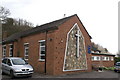
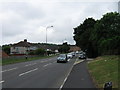
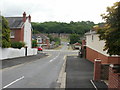
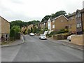
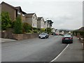
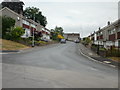
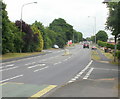
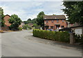
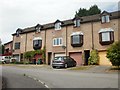

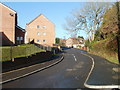
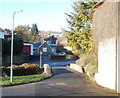
95 photos from this area
Area Information
Key information about the NP19 9DW including its size, population, and administrative classification.
- Area Type
- Postcode
- Area Size
- 2.5 hectares
- Population
- 1643
- Population Density
- 4050 people/km²
House Prices in NP19 9DW
52
Properties
£155,444
Average Sold Price
£45,000
Lowest Price
£290,000
Highest Price
Showing 52 properties
| Address | Type | Beds | Baths | Last Sale Price | Last Sale Date | |
|---|---|---|---|---|---|---|
| 2 Ringwood Avenue, Newport, NP19 9DW | Semi-detached | 3 | 1 | £242,500 | Nov 2025 | |
| 6 Ringwood Avenue, Newport, NP19 9DW | house | 3 | 1 | £262,500 | Nov 2025 | |
| 54 Ringwood Avenue, Newport, NP19 9DW | Semi-detached | 3 | 2 | £290,000 | Jul 2024 | |
| 19 Ringwood Avenue, Newport, NP19 9DW | Semi-detached | 3 | 1 | £238,500 | May 2024 | |
| 36 Ringwood Avenue, Newport, NP19 9DW | house | - | - | £227,000 | Jun 2021 | |
| 60 Ringwood Avenue, Newport, NP19 9DW | house | - | - | £222,500 | Jun 2021 | |
| 27 Ringwood Avenue, Newport, NP19 9DW | Semi-detached | 3 | 1 | £175,000 | Jul 2020 | |
| 7 Ringwood Avenue, Newport, NP19 9DW | Detached | 4 | 2 | £206,000 | Jul 2020 | |
| 50 Ringwood Avenue, Newport, NP19 9DW | house | - | - | £230,000 | Apr 2020 | |
| 35 Ringwood Avenue, Newport, NP19 9DW | Semi-detached | 3 | - | £159,950 | Dec 2019 |
Page 1 of 6
Energy Efficiency in NP19 9DW
Amenities
Schools
| Rank | School | Type | Entry gender | Ages |
|---|
Explore more schools in this area
Go to Schools tabDemographics
Household Size
One person
most common
Accommodation Type
Houses
most common
Tenure
54
majority
Ethnic Group
White
most common
Religion
N/A
most common
Household Composition
N/A
most common
Age
47
median
Adults (30-64 years)
most common
Household Deprivation
N/A
with no deprivation
NS-SEC
27
in Lower managerial occupations
Explore more demographic insights in this area
Go to Demographics tabPlanning
Planning Constraints
- Flood RiskPremium
- Ramsar Wetland SitesPremium
- Area of Outstanding Natural BeautyPremium
- Protected Nature ReservePremium
- Protected WoodlandPremium
- Crime RiskPremium