Area Overview for NP19 8BG
Photos of NP19 8BG
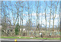
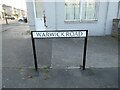
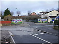
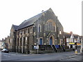
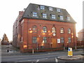
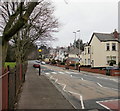
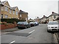
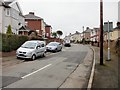
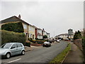
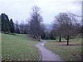
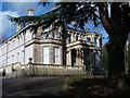
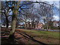
100 photos from this area
Area Information
Key information about the NP19 8BG including its size, population, and administrative classification.
- Area Type
- Postcode
- Area Size
- 3.0 hectares
- Population
- 1270
- Population Density
- 3071 people/km²
House Prices in NP19 8BG
33
Properties
£221,325
Average Sold Price
£78,000
Lowest Price
£380,000
Highest Price
Showing 33 properties
| Address | Type | Beds | Baths | Last Sale Price | Last Sale Date | |
|---|---|---|---|---|---|---|
| 321 Christchurch Road, Newport, NP19 8BG | Detached | 5 | 2 | £380,000 | Dec 2025 | |
| 325 Christchurch Road, Newport, NP19 8BG | Semi-detached | 3 | 2 | £275,000 | Jun 2025 | |
| 297 Christchurch Road, Newport, NP19 8BG | Semi-detached | 3 | 1 | £295,000 | Mar 2025 | |
| 319 Christchurch Road, Newport, NP19 8BG | Semi-detached | 3 | 2 | £320,000 | Dec 2024 | |
| 315 Christchurch Road, Newport, NP19 8BG | Semi-detached | 3 | 1 | £275,000 | Oct 2024 | |
| 299 Christchurch Road, Newport, NP19 8BG | Bungalow | 3 | 1 | £277,500 | Sep 2023 | |
| 323 Christchurch Road, Newport, NP19 8BG | Retail | 3 | 1 | £259,000 | Oct 2022 | |
| 287 Christchurch Road, Newport, NP19 8BG | house | - | - | £320,000 | Dec 2021 | |
| 301A Christchurch Road, Newport, NP19 8BG | house | - | - | £255,000 | Aug 2021 | |
| 283 Christchurch Road, Newport, NP19 8BG | house | - | - | £349,950 | Nov 2020 |
Page 1 of 4
Energy Efficiency in NP19 8BG
Amenities
Schools
| Rank | School | Type | Entry gender | Ages |
|---|
Explore more schools in this area
Go to Schools tabDemographics
Household Size
Two person
most common
Accommodation Type
Houses
most common
Tenure
86
majority
Ethnic Group
White
most common
Religion
N/A
most common
Household Composition
N/A
most common
Age
47
median
Adults (30-64 years)
most common
Household Deprivation
N/A
with no deprivation
NS-SEC
33
in Lower managerial occupations
Explore more demographic insights in this area
Go to Demographics tabPlanning
Planning Constraints
- Flood RiskPremium
- Ramsar Wetland SitesPremium
- Area of Outstanding Natural BeautyPremium
- Protected Nature ReservePremium
- Protected WoodlandPremium
- Crime RiskPremium