Area Overview for NP18 1JJ
Photos of NP18 1JJ
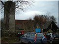
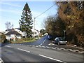
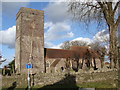

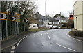
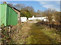
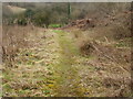
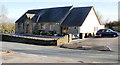
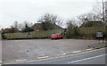
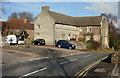
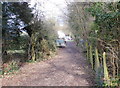
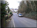
81 photos from this area
Area Information
Key information about the NP18 1JJ including its size, population, and administrative classification.
- Area Type
- Postcode
- Area Size
- 41.7 hectares
- Population
- 1176
- Population Density
- 150 people/km²
House Prices in NP18 1JJ
23
Properties
£521,875
Average Sold Price
£170,000
Lowest Price
£1,090,000
Highest Price
Showing 23 properties
| Address | Type | Beds | Baths | Last Sale Price | Last Sale Date | |
|---|---|---|---|---|---|---|
| The Old Rectory, Christchurch Road, Newport, NP18 1JJ | Detached | 6 | 3 | £850,000 | Feb 2025 | |
| Cairn Cap, Christchurch Road, Newport, NP18 1JJ | Bungalow | 2 | 1 | £410,000 | Dec 2024 | |
| The Friars, Christchurch Road, Newport, NP18 1JJ | house | - | - | £170,000 | Sep 2023 | |
| Five Oaks, Christchurch Road, Newport, NP18 1JJ | Detached | 5 | 3 | £740,000 | Sep 2022 | |
| Rhos Lan, Christchurch Road, Newport, NP18 1JJ | house | - | - | £1,090,000 | Sep 2022 | |
| Highfield House, Christchurch Road, Newport, NP18 1JJ | Detached | 3 | 1 | £335,000 | Aug 2016 | |
| High Meadow, Christchurch Road, Newport, NP18 1JJ | house | - | - | £385,000 | Jul 2015 | |
| Brambles, Christchurch Road, Newport, NP18 1JJ | Detached | - | - | £195,000 | Apr 2003 | |
| Springfield, Christchurch Road, Newport, NP18 1JJ | Detached | 3 | 1 | - | - | |
| Church House, Christchurch Road, Newport, NP18 1JJ | Detached | 3 | - | - | - |
Page 1 of 3
Energy Efficiency in NP18 1JJ
Amenities
Schools
| Rank | School | Type | Entry gender | Ages |
|---|
Explore more schools in this area
Go to Schools tabDemographics
Household Size
Two person
most common
Accommodation Type
Houses
most common
Tenure
81
majority
Ethnic Group
White
most common
Religion
N/A
most common
Household Composition
N/A
most common
Age
47
median
Adults (30-64 years)
most common
Household Deprivation
N/A
with no deprivation
NS-SEC
46
in Lower managerial occupations
Explore more demographic insights in this area
Go to Demographics tabPlanning
Planning Constraints
- Flood RiskPremium
- Ramsar Wetland SitesPremium
- Area of Outstanding Natural BeautyPremium
- Protected Nature ReservePremium
- Protected WoodlandPremium
- Crime RiskPremium