Area Overview for NP19 7GQ
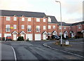
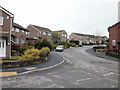
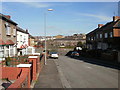
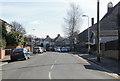
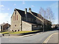
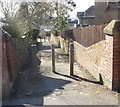
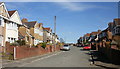
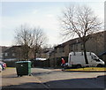
Photos of NP19 7GQ


Area Information
Living in NP19 7GQ means residing within a tightly knit residential cluster defined by its specific postcode boundary. This small area covers just 4507 square metres, creating an intimate setting where neighbours are likely to be regular faces. The population stands at 1289 people, resulting in an exceptionally high population density of 285981 people per square kilometre. You are not looking at sprawling suburbs here; you are entering a concentrated community where daily life unfolds in close quarters. The location serves as a distinct residential hub within the wider Newport region of Wales. Its compact nature suggests a neighbourhood where local issues and community events have immediate impact on everyone. Daily life likely revolves around the immediate vicinity, relying heavily on local connections rather than distant escapism. While the density creates a bustling feel, the specific land use is almost exclusively residential, offering a quiet retreat from the wider urban noise. You are buying into a very specific slice of property where individual privacy exists within a shared, microscopic footprint.
- Area Type
- Postcode
- Area Size
- 4507 m²
- Population
- 1289
- Population Density
- 9341 people/km²
The property market in NP19 7GQ is characterised by a strong leaning towards ownership, with houses making up the primary accommodation type. You are looking at a market where 70% of residents own their homes, which signals a stable environment rather than a volatile rental sector. When considering homes in NP19 7GQ, you should be prepared for a stock dominated by detached and semi-detached dwellings typical of the South Wales region. This ownership rate means that sellers are often existing homeowners hoping to upgrade or downsize, rather than new developers disrupting the market. The area's small size of just over 4500 square metres further constrains the housing supply, potentially driving up prices for suitable properties. Living in this postcode cluster offers security of tenure for the majority, as the low rental proportion suggests fewer future changes in landlord-tenant dynamics. Buyers here are often purchasing for retirement, raising older children, or seeking a quiet, owned property away from the city centre. The market reflects a community that has built its value on established housing rather than short-term lets.
House Prices in NP19 7GQ
Showing 24 properties
| Address | Type | Beds | Baths | Last Sale Price | Last Sale Date | |
|---|---|---|---|---|---|---|
| 182 Caerleon Road, Newport, NP19 7GQ | Terraced | 3 | 1 | £225,000 | Nov 2025 | |
| 208 Caerleon Road, Newport, NP19 7GQ | Terraced | 3 | 1 | £187,000 | Jun 2025 | |
| 176 Caerleon Road, Newport, NP19 7GQ | Terraced | 3 | 1 | £185,000 | Apr 2025 | |
| 192 Caerleon Road, Newport, NP19 7GQ | Terraced | 3 | 1 | £170,000 | Nov 2023 | |
| 184 Caerleon Road, Newport, NP19 7GQ | house | - | - | £200,000 | Jan 2022 | |
| 194 Caerleon Road, Newport, NP19 7GQ | Terraced | 3 | 2 | £163,000 | Aug 2018 | |
| 220 Caerleon Road, Newport, NP19 7GQ | Terraced | 3 | 1 | £126,000 | Jun 2017 | |
| 218 Caerleon Road, Newport, NP19 7GQ | Terraced | 3 | 1 | £132,500 | Feb 2017 | |
| 190 Caerleon Road, Newport, NP19 7GQ | Terraced | 3 | 1 | £100,000 | Feb 2015 | |
| 196 Caerleon Road, Newport, NP19 7GQ | house | - | - | £98,000 | Nov 2009 |
Energy Efficiency in NP19 7GQ
Your lifestyle in NP19 7GQ will be supported by a selection of amenities located within practical reach. Retail options include a Spar, Tesco Caerleon, and Aldi Albany Street, providing sufficient variety for most household grocery and shopping requirements. You have five retail outlets nearby, ensuring you can fill a weekly shop without travelling far. For commuting, rail is the primary mode of connection, with five stations including Newport Railway Station, Pye Corner Railway Station, and Rogerstone Railway Station. These stations offer direct routes to major employment hubs and other points of interest across the region. Beyond road and rail, a ferry service is available via the Newport Ferry Terminal, adding a transport option that may connect you to the waterfront or the Isle of Wight depending on the season. This variety of transport links means you are never isolated from the wider network of services surrounding this small residential zone.
Amenities
Schools
Families considering NP19 7GQ will find several educational institutions within practical reach to support their children. Durham Road Junior School and Durham Road Infant School are the key educational facilities listed for your immediate convenience. These schools serve different age groups, offering continuity of education as a child moves from early years to the upper years of compulsory schooling. Both institutions are classified as 'other' in their type categorisation, which accounts for their rural or semi-rural nature outside the standard metropolitan framework. This mix provides a straightforward educational path without the need for long commutes to larger town centres. If you have younger children, the Infant School will be relevant, while the Junior School caters to those advancing in age. The proximity of these facilities means you do not need to look further for primary education options. Parents of local residents benefit from stable schooling options right at the doorstep of your future home in this specific postcode area.
| Rank | School | Type | Entry gender | Ages |
|---|
Explore more schools in this area
Go to Schools tabDemographics
The community in NP19 7GQ is dominated by older residents, with a median age of 47 years. The most common age group comprises adults between 30 and 64 years old, indicating a demographic that has largely settled down. This age profile suggests a neighbourhood that attracts families with older children or empty nesters rather than young students or transient workers. Home ownership is extremely prevalent, standing at a solid 70% of the total population. This high rate points to a community of settled homeowners who have invested in their local property over time rather than a transient rental market. The predominant accommodation type consists of houses, which aligns with the home ownership statistics and the mature nature of the population. Ethnically, the area is predominantly White, reflecting a homogeneous community structure typical of established residential clusters in this part of Wales. While 30% of residents do not own their homes, the overwhelming majority belong to groups that value stability and long-term residence within these specific boundaries.
Household Size
Accommodation Type
Tenure
Ethnic Group
Religion
Household Composition
Age
Household Deprivation
NS-SEC
Explore more demographic insights in this area
Go to Demographics tabPlanning
Planning Constraints
- Flood RiskPremium
- Ramsar Wetland SitesPremium
- Area of Outstanding Natural BeautyPremium
- Protected Nature ReservePremium
- Protected WoodlandPremium
- Crime RiskPremium