Area Overview for NP19 7DN
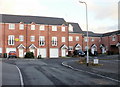
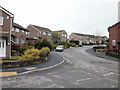
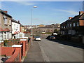
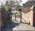
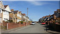
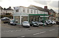
Photos of NP19 7DN


Area Information
Living in NP19 7DN offers a quiet residential experience within a compact territory of 4467 square metres. This specific postcode covers a small cluster where 1,289 residents call home, creating a tightly knit environment. The density here stands at 288,561 people per square kilometre according to the data, which reflects the concentrated nature of this Welsh postcode. Daily life in NP19 7DN is defined by proximity to key services while maintaining a distinct neighbourhood feel. You will find that this area sits comfortably outside the absolute core of Newport yet remains connected to the wider region through rail links and local retail options. The mix of families and established adults shapes the character of the street. There are no major planning constraints such as protected woodlands or wetlands within the immediate boundaries of this postcode. This means development is subject to standard local planning rules rather than special environmental protections. For those seeking a home in Wales, NP19 7DN provides a practical example of how urban and semi-rural elements can coexist. The area functions as a solid base for those who value straightforward living without the complications of complex conservation areas.
- Area Type
- Postcode
- Area Size
- 4467 m²
- Population
- 1289
- Population Density
- 9341 people/km²
The property market in NP19 7DN is defined by a heavy leaning towards owner-occupied housing. With 70% of the population owning their homes, this area functions as a traditional residential zone rather than a student or high-turnover rental market. The accommodation type listed is houses, meaning you will find detached,semi-detached, and terraced properties rather than flats or apartments. This structure makes the area particularly attractive to families who require space and gardens. The size of the postcode at 4467 square metres limits the total number of listings available at any one time. Buyers should move quickly if they identify a suitable property within this small cluster. The high density figure of 288,561 people per square kilometre is an aggregate measure that can influence perceived value per square foot within the specific streets that comprise this postcode. Since most homes are occupied by their owners, the neighbourhood tends to be quieter outside of school run hours. Transitioning homes in NP19 7DN often means purchasing a home with an existing sense of community attached. The lack of flats means that buyers looking for communal living options or ground-floor access on a higher storey will not find them here. The market remains steady, driven by the need within the local workforce for stable living quarters near the city limits.
House Prices in NP19 7DN
Showing 17 properties
| Address | Type | Beds | Baths | Last Sale Price | Last Sale Date | |
|---|---|---|---|---|---|---|
| 11 Orchard Street, Newport, NP19 7DN | Terraced | 2 | 1 | £185,000 | Mar 2025 | |
| 13 Orchard Street, Newport, NP19 7DN | Terraced | 3 | 1 | £149,500 | Jan 2025 | |
| 1 Orchard Street, Newport, NP19 7DN | Terraced | 3 | 1 | £168,000 | Aug 2024 | |
| 14 Orchard Street, Newport, NP19 7DN | Terraced | 3 | 1 | £167,500 | Mar 2023 | |
| 6 Orchard Street, Newport, NP19 7DN | house | 2 | 1 | £190,000 | Sep 2022 | |
| 3 Orchard Street, Newport, NP19 7DN | house | - | - | £147,500 | May 2022 | |
| 8 Orchard Street, Newport, NP19 7DN | house | 2 | 1 | £175,000 | Dec 2021 | |
| 2 Orchard Street, Newport, NP19 7DN | Bungalow | 1 | 1 | £75,000 | Jul 2020 | |
| 4 Orchard Street, Newport, NP19 7DN | Terraced | 3 | 1 | £134,000 | Mar 2019 | |
| 5 Orchard Street, Newport, NP19 7DN | Terraced | - | - | £63,000 | Jan 2002 |
Energy Efficiency in NP19 7DN
Daily life in NP19 7DN is supported by a network of shops, stations, and leisure facilities located just a short distance away. Residents have access to five retail outlets in immediate proximity. Notable names include Spar, Tesco Caerleon, and Aldi Albany Street, which provide all the essentials for running a household. There are no need for long drives to find groceries or household goods. Travel logistics are handled efficiently by five nearby railway stations, including Newport Railway Station and Pye Corner Railway Station. These hubs allow quick escapes into the wider region without the stress of traffic. For those visiting the coast, Newport Ferry Terminal is just a practical distance away, offering potential links to other parts of Wales. The size of the postcode at 4467 square metres means you will know your neighbours, but you can still travel far when desired. The local amenities create a self-contained bubble of convenience centred on quality of life. You can buy your coffee, do your weekly shop, and catch a train from established clusters around NP19 7DN. The presence of Aldi and Tesco signals a commitment to value and variety in the retail offers available. This blend of necessary services and transport links defines the lifestyle for anyone choosing to live in this specific area of Wales.
Amenities
Schools
Families living in NP19 7DN have access to two specific educational institutions within their catchment or immediate vicinity. The nearest options are Durham Road Junior School and Durham Road Infant School. Both schools are classified as 'other' in the available records, which means they do not fall under the standard state-sector Ofsted rating categories typically seen in large data sets. While the specific inspection ratings are not published, the presence of these two institutions confirms that primary education is a core service for residents. The mix of infant and junior divisions suggests a structured local education system designed to serve children from early years through to adolescence. For parents moving into NP19 7DN, the proximity to Durham Road schools is a primary consideration. The 'other' classification indicates these may be community or voluntary aided institutions common in Wales, rather than full academies. You should verify the current Ofsted status directly with the Department for Education or the local council before making a final decision. The availability of these schools supports the demographic of families with children residing in the area. There are no comprehensive schools named in the immediate data for this specific postcode group, meaning secondary education is likely accessed through broader catchment areas outside NP19 7DN.
| Rank | School | Type | Entry gender | Ages |
|---|
Explore more schools in this area
Go to Schools tabDemographics
The community in NP19 7DN reflects a settled population with a median age of 47 years. Adults between 30 and 64 years represent the most common age range, indicating that families and established professionals dominate the neighbourhood. House ownership is the primary tenure model, with 70% of residents owning their homes outright or via a mortgage. The remaining 30% likely reside in rented accommodation, though the specific breakdown of private versus social renting is not detailed in the source data. The predominant ethnic group is White, which aligns with the broader demographic profile of the surrounding Montrose region. While the area is diverse in its human interests, the census data highlights a clear majority in terms of ethnic heritage. The high level of home ownership suggests stability and long-term roots rather than transient living arrangements. People in this area often plan for generations, influencing school choices and local involvement. The accommodation type is exclusively houses, which reinforces the family-oriented character of the locality. This demographic profile points to a neighbourhood where key decision makers have significant sway over local amenities and future developments.
Household Size
Accommodation Type
Tenure
Ethnic Group
Religion
Household Composition
Age
Household Deprivation
NS-SEC
Explore more demographic insights in this area
Go to Demographics tabPlanning
Planning Constraints
- Flood RiskPremium
- Ramsar Wetland SitesPremium
- Area of Outstanding Natural BeautyPremium
- Protected Nature ReservePremium
- Protected WoodlandPremium
- Crime RiskPremium