Area Overview for NP19 7DQ
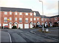
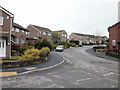
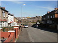
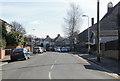
Photos of NP19 7DQ


Area Information
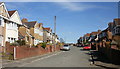
Living in NP19 7DQ means residing within a tightly knit residential cluster located in Wales. This specific postcode covers an area of just 3,926 square metres, creating a compact environment where residents know each other. The population stands at 1,289 people, resulting in a high density of 328,315 people per square kilometre compared to national averages. Such compact living suits those who value proximity to neighbours and local amenities rather than large estates. Daily life here is defined by convenience and a strong sense of community within a small geographic footprint. You will find a neighbourhood where the average household size suggests stable, established residents. The mix of homes reflects a settled population rather than transient accommodation seekers. This area offers a straightforward property search experience because the inventory is limited and specific. Prospective buyers should focus on the unique characteristics of this small cluster rather than expecting the variety found in larger towns. Understanding the scale of NP19 7DQ helps you appreciate the intimacy of local interactions and the quiet pace of life available here.
- Area Type
- Postcode
- Area Size
- 3926 m²
- Population
- 1289
- Population Density
- 9341 people/km²
The housing market in NP19 7DQ is characterised by a predominance of houses rather than apartments or flats. This alignment with house types supports the needs of families and older adults seeking traditional residential features. Home ownership stands at 70%, making this significantly more of an owner-occupied area than a private rental sector. When looking at homes in NP19 7DQ, you will find that purchase is the standard route for securing a place to live. The small total area of 3,926 square metres means the number of available properties is limited compared to larger suburbs. This scarcity often drives values and competition among local buyers. The cluster nature of the settlement implies a finite supply of homes rather than continuous new development zones. Buyers looking at this postcode should expect a market where properties hold value due to their age and location. The high ownership rate further reinforces that this is a neighbourhood where people buy to stay. Understanding these constraints helps you navigate the limited selection of available dwellings effectively.
House Prices in NP19 7DQ
Showing 15 properties
| Address | Type | Beds | Baths | Last Sale Price | Last Sale Date | |
|---|---|---|---|---|---|---|
| 3 Stafford Road, Newport, NP19 7DQ | Terraced | 3 | 1 | £165,000 | Apr 2020 | |
| 4 Stafford Road, Newport, NP19 7DQ | Terraced | 3 | 1 | £127,000 | Dec 2019 | |
| 11 Stafford Road, Newport, NP19 7DQ | Terraced | 2 | - | £116,250 | Nov 2018 | |
| 13 Stafford Road, Newport, NP19 7DQ | Terraced | - | - | £132,000 | Feb 2018 | |
| 2 Stafford Road, Newport, NP19 7DQ | Terraced | 2 | 1 | £100,000 | Jun 2016 | |
| 7 Stafford Road, Newport, NP19 7DQ | house | - | - | £93,000 | Mar 2016 | |
| 10 Stafford Road, Newport, NP19 7DQ | house | - | - | £114,740 | Sep 2010 | |
| 12 Stafford Road, Newport, NP19 7DQ | Terraced | 3 | 1 | £122,000 | Sep 2009 | |
| 9 Stafford Road, Newport, NP19 7DQ | Terraced | 3 | 1 | £112,000 | Oct 2008 | |
| 5 Stafford Road, Newport, NP19 7DQ | Terraced | - | - | £116,000 | Jun 2006 |
Energy Efficiency in NP19 7DQ
Residents of NP19 7DQ enjoy immediate access to a range of retail, rail, and ferry amenities within walking or short driving distance. For daily shopping, Spar, Tesco Caerleon, and Aldi Albany Street provide essential groceries and household basics. These five retail outlets cover the majority of typical consumer needs without requiring long journeys. Transport links are equally convenient, with five rail stations nearby including Newport, Pye Corner, and Rogerstone. The single Newport Ferry Terminal offers additional connectivity for those travelling across the River Usk. This blend of shops and transport options means you can manage your personal and professional life with minimal travel time. The character of this lifestyle is defined by practicality and accessibility rather than distant leisure destinations. You do not need to travel far for fresh food or train tickets to meet your daily requirements. The presence of these specific venues like Tesco Caerleon and the Newport Railway Station creates a self-contained environment. Living in NP19 7DQ offers a balanced routine where work, school runs, and shopping coexist smoothly.
Amenities
Schools
Families living in NP19 7DQ have access to two specific local educational institutions within the council's jurisdiction. Durham Road Junior School and Durham Road Infant School serve as the primary nearby options for younger children. These schools operate under the 'other' classification within the current dataset, meaning they cover the foundational years of a child's education. The presence of both infant and junior sections means these institutions cater to children from early reception through to the transition year into secondary education. You will not find middle or secondary school names listed in the immediate vicinity data, so larger nearby towns likely handle that stage. For residents prioritising education, the combination of Durham Road Junior School and Durham Road Infant School offers a complete early learning package within the local cluster. Choosing schools near NP19 7DQ often means enrolling children in establishments with established local reputations. The proximity of these facilities is a key factor for parents balancing work and family commitments in this small residential zone.
| Rank | School | Type | Entry gender | Ages |
|---|
Explore more schools in this area
Go to Schools tabDemographics
The community in NP19 7DQ reflects a mature and established population. The median age is 47 years, which aligns with the most common age range of adults between 30 and 64 years. This demographic profile indicates a neighbourhood dominated by working families and individuals in their prime earning years. Home ownership is strong, with 70% of residents owning their properties outright or with a mortgage. This high ownership rate suggests long-term stability and an investment-focused community rather than a transient rental sector. The predominant ethnic group is White, mirroring the broader national composition of the region. Accommodation predominantly consists of houses, fitting the preference of this age group for garden space and private living areas. The absence of significant youth dependency or very old-age demographics means local services cater primarily to working adults and their families. You will encounter neighbours who have likely lived in their homes for many years. This stability creates a supportive environment where community matters are shared responsibilities. The data confirms a mature market where decisions are made carefully and residents value continuity.
Household Size
Accommodation Type
Tenure
Ethnic Group
Religion
Household Composition
Age
Household Deprivation
NS-SEC
Explore more demographic insights in this area
Go to Demographics tabPlanning
Planning Constraints
- Flood RiskPremium
- Ramsar Wetland SitesPremium
- Area of Outstanding Natural BeautyPremium
- Protected Nature ReservePremium
- Protected WoodlandPremium
- Crime RiskPremium