Area Overview for NP19 7BR
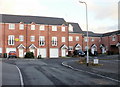
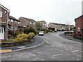
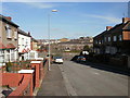
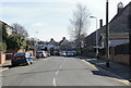
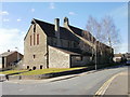
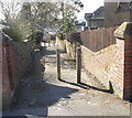
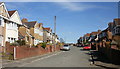
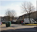
Photos of NP19 7BR


Area Information
NP19 7BR represents a small residential cluster located in Wales, covering an area of just one hectare. This compact footprint holds a population of 1,662 residents, creating a setting where proximity is inherent to daily life. The postcode serves as a specific entry point for those looking at homes in NP19 7BR, offering a tightly knit environment rather than a sprawling suburb. Living in this area means you are situated within a community where the built environment is concentrated. The total demographic consists entirely of freeholders, with no mention of shared ownership or leasehold variations in the available information. The slight density of 162,397 people per square kilometre reflects the urban nature of this specific cluster within the broader Newport landscape. You can expect a neighbourhood defined by its residential focus, surrounded by the facilities necessary for a practical and convenient routine. The area stands as a distinct physical unit on the map, separate from the larger surrounding districts yet fully integrated into the local transport and service networks.
- Area Type
- Postcode
- Area Size
- 1.0 hectares
- Population
- 1662
- Population Density
- 4949 people/km²
The housing market in NP19 7BR is defined by a stock comprised primarily of houses. This area does not serve as a hub for flats or apartments; every home available is a house structure. Sixty-one per cent of the population are owner-occupiers, meaning the majority of these properties are held by their residents rather than landlords. For buyers looking at homes in NP19 7BR, this translates to a market weighted towards owner-occupied transactions rather than the private rented sector. The small physical size of the postcode, measuring just one hectare, implies a limited selection of individual properties within this specific grid. Anyone seeking a house in this cluster will find that the market corresponds with the majority tenure status of owner-occupancy. The data does not provide specific price points or sales velocity, but the household structure points to a traditional family home environment. You are looking at a market where properties are likely suited to families or couples who value the space provided by houses over smaller accommodations.
House Prices in NP19 7BR
Showing 46 properties
| Address | Type | Beds | Baths | Last Sale Price | Last Sale Date | |
|---|---|---|---|---|---|---|
| 217 Thirlmere Place, Newport, NP19 7BR | Retail | 3 | 1 | £152,000 | Oct 2022 | |
| 244 Thirlmere Place, Newport, NP19 7BR | house | - | - | £147,000 | Feb 2021 | |
| 215 Thirlmere Place, Newport, NP19 7BR | house | 3 | 2 | £105,000 | Feb 2020 | |
| 233 Thirlmere Place, Newport, NP19 7BR | Terraced | 3 | 1 | £124,950 | Jul 2017 | |
| 234 Thirlmere Place, Newport, NP19 7BR | Terraced | 3 | - | £70,000 | Jan 2014 | |
| 223 Thirlmere Place, Newport, NP19 7BR | Terraced | - | - | £34,950 | Jun 2003 | |
| 228 Thirlmere Place, Newport, NP19 7BR | Semi-detached | - | - | £45,950 | Jul 2002 | |
| 227 Thirlmere Place, Newport, NP19 7BR | Terraced | - | - | £42,000 | Apr 2002 | |
| 230 Thirlmere Place, Newport, NP19 7BR | Terraced | - | - | £36,850 | Oct 1999 | |
| 235 Thirlmere Place, Newport, NP19 7BR | Terraced | - | - | £35,000 | Mar 1997 |
Energy Efficiency in NP19 7BR
Daily life in NP19 7BR benefits from immediate access to several key amenities, ensuring you do not need to travel far for essential services. Retail options are conveniently located, with Spar, Tesco Caerleon, and Aldi Albany Street providing food and household necessities. You can choose between these three distinct retailers depending on your shopping preferences and prices. Transport links are extensive for a residential cluster of this size, with five railway options nearby including Newport Railway Station, Pye Corner Railway Station, and Rogerstone Railway Station. If you require maritime transport, Newport Ferry Terminal is located near this postcode. These amenities create a lifestyle where daily errands are short and manageable. Living in NP19 7BR allows you to maintain a focused residential routine while having immediate access to supermarkets and transport hubs. The presence of Tesco Caerleon and Aldi specifically suggests that high-street and bulk shopping are both viable options for the residents.
Amenities
Schools
| Rank | School | Type | Entry gender | Ages |
|---|
Explore more schools in this area
Go to Schools tabDemographics
The community residing in NP19 7BR reflects the demographics of a settled population, with a median age of 47 years. The most common age range consists of adults between 30 and 64 years, indicating a neighbourhood dominated by working families and established households rather than students or empty nesters. Home ownership stands at 61 per cent, revealing a strong tradition of residents who own their properties outright or through a mortgage rather than renting. This high level of ownership suggests stability and long-term commitment from the people living in this postcode. The primary accommodation type comprises houses, although data does not disaggregate whether these are detached, semi-detached, or terraced structures. Demographically, the predominant ethnic group is White, aligning with the broader national profile of Wales. The area lacks data on deprivation levels or detailed income breakdowns, but the age profile and ownership rate suggest a middle-aged, property-owning demographic. This community is characterised by a mature population where residents have established roots in the locality.
Household Size
Accommodation Type
Tenure
Ethnic Group
Religion
Household Composition
Age
Household Deprivation
NS-SEC
Explore more demographic insights in this area
Go to Demographics tabPlanning
Planning Constraints
- Flood RiskPremium
- Ramsar Wetland SitesPremium
- Area of Outstanding Natural BeautyPremium
- Protected Nature ReservePremium
- Protected WoodlandPremium
- Crime RiskPremium