Area Overview for NP19 7BL
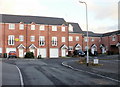
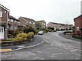
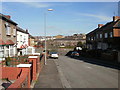
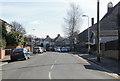
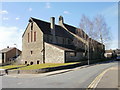
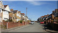
Photos of NP19 7BL


Area Information
Living in NP19 7BL offers residents a very specific type of residential experience defined by its compact nature. This postcode covers a precise 1.0 hectare cluster, creating a densely populated neighbourhood where streets are closely packed. You are part of a community numbering 1,662 people, meaning local services and neighbours are immediately nearby. The area is located in Wales, offering a distinct character compared to English councils while maintaining strong regional links. Daily life here revolves around a tight-knit environment where the proximity of homes fosters frequent neighbourly interaction. The small footprint means you rarely face the long commutes associated with sprawling urban sprawl, yet you remain well-positioned to access wider facilities when required. Residents enjoy a balance between the convenience of a small village setting and the practical reach of a larger urban infrastructure. Whether you are walking to a shop or catching a train, the scale of NP19 7BL ensures that essential journeys are short and predictable. It is a place where the community is visibly present within the physical space around your doorstep.
- Area Type
- Postcode
- Area Size
- 1.0 hectares
- Population
- 1662
- Population Density
- 4949 people/km²
The property market in NP19 7BL is characterised by a stock dominated by private ownership rather than rental schemes. With 61% of homes occupied by their owners, the area feels like an established community where people have invested in the brick and mortar around them. Houses are the primary accommodation type, meaning you will find detached and semi-detached properties typical of Welsh residential development. This predominance of owner-occupiers often results in a market where property values reflect local improvement efforts and family renovations. Buyers looking for homes in NP19 7BL can expect to find listings that have been maintained over time, as owners are generally motivated to keep their assets up to standard. The small size of the postcode means that the variety of property styles is limited compared to larger towns, but the consistency of housing stock provides a reliable picture for potential purchasers. It is not a dynamic student rental hub or a transient housing estate; it is a residential zone where people put down roots. This stability can make it an attractive option for those seeking a hassle-free property search without the volatility often found in high-turnover rental sectors.
House Prices in NP19 7BL
Showing 54 properties
| Address | Type | Beds | Baths | Last Sale Price | Last Sale Date | |
|---|---|---|---|---|---|---|
| 166 Buttermere Way, Newport, NP19 7BL | Detached | 3 | 1 | £210,500 | Jul 2025 | |
| 182 Buttermere Way, Newport, NP19 7BL | Terraced | 3 | 1 | £180,000 | Apr 2025 | |
| 193 Buttermere Way, Newport, NP19 7BL | Semi-detached | 3 | 1 | £145,000 | Sep 2024 | |
| 204 Buttermere Way, Newport, NP19 7BL | Terraced | 3 | 1 | £185,000 | Oct 2022 | |
| 181 Buttermere Way, Newport, NP19 7BL | house | - | - | £95,000 | May 2013 | |
| 163 Buttermere Way, Newport, NP19 7BL | house | - | - | £90,000 | Nov 2008 | |
| 153 Buttermere Way, Newport, NP19 7BL | Terraced | - | - | £109,450 | Jan 2007 | |
| 152 Buttermere Way, Newport, NP19 7BL | house | - | - | - | - | |
| 179 Buttermere Way, Newport, NP19 7BL | house | - | - | - | - | |
| 183 Buttermere Way, Newport, NP19 7BL | house | - | - | - | - |
Energy Efficiency in NP19 7BL
Your lifestyle in NP19 7BL is supported by a practical array of amenities within your immediate reach. Five retail outlets serve the area, including a Spar, Tesco Caerleon, and Aldi Albany Street, ensuring you can shop without travelling far for groceries. Five railway stations are nearby, providing easy rail access via Newport Railway Station, Pye Corner Railway Station, and Rogerstone Railway Station. If you need to commute by boat, Newport Ferry Terminal is just a short distance away. These transport links offer flexibility for both work commutes and leisure trips. You do not need a car for every journey, as the combination of shops and rail stations covers most daily needs. The presence of major supermarkets like Tesco and Aldi means you can stock up on essentials locally. The rail network connects you efficiently to wider destinations, while the ferry terminal offers unique travel options to mainland Britain. This convenient layout ensures that your daily routine involves short trips to high-quality services.
Amenities
Schools
| Rank | School | Type | Entry gender | Ages |
|---|
Explore more schools in this area
Go to Schools tabDemographics
The community within NP19 7BL has a clearly defined age structure that influences its atmosphere and activities. Adults between 30 and 64 years old form the most common age range, shaping the local character with families and professional workers. The median age stands at 47 years, indicating a mature population that has likely been living in the area for some time. Home ownership is strong at 61%, suggesting a stable community with significant investment in local properties. Most residents live in houses rather than other accommodation types, contributing to a suburban rather than high-rise living feel. The population is predominantly White, reflecting the broader demographic trends of South Wales. This demographic profile means that schools and local amenities cater primarily to a middle-aged core. The high level of ownership often leads to residents who are involved in local governance and community groups. You will find a mix of long-term families and established professionals who value stability. The age distribution suggests a quiet enviorment where activities focus on practical needs and family life rather than transient student populations.
Household Size
Accommodation Type
Tenure
Ethnic Group
Religion
Household Composition
Age
Household Deprivation
NS-SEC
Explore more demographic insights in this area
Go to Demographics tabPlanning
Planning Constraints
- Flood RiskPremium
- Ramsar Wetland SitesPremium
- Area of Outstanding Natural BeautyPremium
- Protected Nature ReservePremium
- Protected WoodlandPremium
- Crime RiskPremium