Area Overview for NP19 0EL
Photos of NP19 0EL
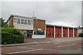
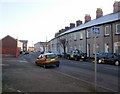
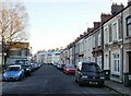
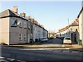
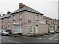

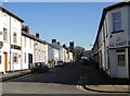
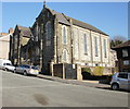
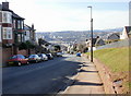
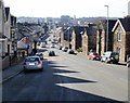
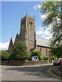
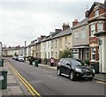
100 photos from this area
Area Information
Key information about the NP19 0EL including its size, population, and administrative classification.
- Area Type
- Postcode
- Area Size
- 7559 m²
- Population
- 2212
- Population Density
- 8778 people/km²
House Prices in NP19 0EL
40
Properties
£82,393
Average Sold Price
£27,005
Lowest Price
£160,000
Highest Price
Showing 40 properties
| Address | Type | Beds | Baths | Last Sale Price | Last Sale Date | |
|---|---|---|---|---|---|---|
| 43 Halstead Street, Newport, NP19 0EL | Terraced | 3 | 1 | £160,000 | Nov 2023 | |
| 41 Halstead Street, Newport, NP19 0EL | Terraced | 3 | 1 | £140,000 | Aug 2021 | |
| 62 Halstead Street, Newport, NP19 0EL | Terraced | 2 | 1 | £115,000 | Jul 2021 | |
| 40 Halstead Street, Newport, NP19 0EL | Terraced | 3 | 2 | £137,950 | Nov 2018 | |
| 66 Halstead Street, Newport, NP19 0EL | Terraced | 3 | - | £109,000 | Sep 2017 | |
| 72 Halstead Street, Newport, NP19 0EL | Terraced | 3 | - | £75,000 | Sep 2012 | |
| 47 Halstead Street, Newport, NP19 0EL | Terraced | - | - | £108,000 | Feb 2008 | |
| 76 Halstead Street, Newport, NP19 0EL | Terraced | 3 | 1 | £96,000 | Feb 2007 | |
| 64 Halstead Street, Newport, NP19 0EL | house | - | - | £100,000 | Dec 2006 | |
| 36 Halstead Street, Newport, NP19 0EL | Terraced | - | - | £95,000 | Jan 2006 |
Page 1 of 4
Energy Efficiency in NP19 0EL
Amenities
Schools
| Rank | School | Type | Entry gender | Ages |
|---|
Explore more schools in this area
Go to Schools tabDemographics
Household Size
Family (3-5 people)
most common
Accommodation Type
Houses
most common
Tenure
53
majority
Ethnic Group
White
most common
Religion
N/A
most common
Household Composition
N/A
most common
Age
47
median
Adults (30-64 years)
most common
Household Deprivation
N/A
with no deprivation
NS-SEC
20
in Lower managerial occupations
Explore more demographic insights in this area
Go to Demographics tabPlanning
Planning Constraints
- Flood RiskPremium
- Ramsar Wetland SitesPremium
- Area of Outstanding Natural BeautyPremium
- Protected Nature ReservePremium
- Protected WoodlandPremium
- Crime RiskPremium