Area Overview for NP19 0DU
Photos of NP19 0DU
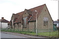
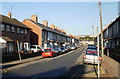
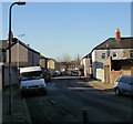
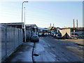
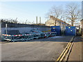
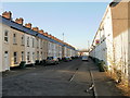
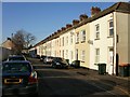
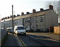
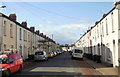
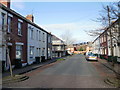
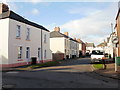
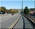
100 photos from this area
Area Information
Key information about the NP19 0DU including its size, population, and administrative classification.
- Area Type
- Postcode
- Area Size
- 6678 m²
- Population
- 2212
- Population Density
- 8778 people/km²
House Prices in NP19 0DU
31
Properties
£75,861
Average Sold Price
£21,000
Lowest Price
£158,000
Highest Price
Showing 31 properties
| Address | Type | Beds | Baths | Last Sale Price | Last Sale Date | |
|---|---|---|---|---|---|---|
| 10 Feering Street, Newport, NP19 0DU | house | 2 | 1 | £135,000 | Oct 2022 | |
| 14 Feering Street, Newport, NP19 0DU | house | 3 | 1 | £158,000 | Mar 2022 | |
| 8 Feering Street, Newport, NP19 0DU | Terraced | 2 | 1 | £124,000 | Mar 2022 | |
| 6 Feering Street, Newport, NP19 0DU | Terraced | 3 | 1 | £140,000 | Feb 2022 | |
| 54 Feering Street, Newport, NP19 0DU | Terraced | 3 | 1 | £104,000 | Jul 2020 | |
| 48 Feering Street, Newport, NP19 0DU | Terraced | 3 | 1 | £112,500 | Nov 2018 | |
| 38 Feering Street, Newport, NP19 0DU | Terraced | 3 | 1 | £52,000 | Aug 2015 | |
| 24 Feering Street, Newport, NP19 0DU | Terraced | 3 | - | £56,000 | Nov 2013 | |
| 60 Feering Street, Newport, NP19 0DU | house | - | - | £76,000 | Feb 2013 | |
| 18 Feering Street, Newport, NP19 0DU | house | - | - | £82,000 | Oct 2009 |
Page 1 of 4
Energy Efficiency in NP19 0DU
Amenities
Schools
| Rank | School | Type | Entry gender | Ages |
|---|
Explore more schools in this area
Go to Schools tabDemographics
Household Size
Family (3-5 people)
most common
Accommodation Type
Houses
most common
Tenure
53
majority
Ethnic Group
White
most common
Religion
N/A
most common
Household Composition
N/A
most common
Age
47
median
Adults (30-64 years)
most common
Household Deprivation
N/A
with no deprivation
NS-SEC
20
in Lower managerial occupations
Explore more demographic insights in this area
Go to Demographics tabPlanning
Planning Constraints
- Flood RiskPremium
- Ramsar Wetland SitesPremium
- Area of Outstanding Natural BeautyPremium
- Protected Nature ReservePremium
- Protected WoodlandPremium
- Crime RiskPremium