Area Overview for NP18 2PH
Photos of NP18 2PH
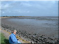
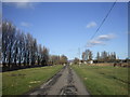
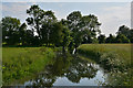
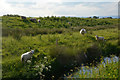
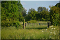

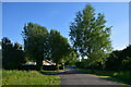

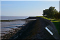
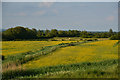
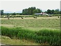
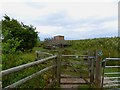
84 photos from this area
Area Information
Key information about the NP18 2PH including its size, population, and administrative classification.
- Area Type
- Postcode
- Area Size
- 2.1 km²
- Population
- 1780
- Population Density
- 47 people/km²
House Prices in NP18 2PH
22
Properties
£369,500
Average Sold Price
£111,000
Lowest Price
£780,000
Highest Price
Showing 22 properties
| Address | Type | Beds | Baths | Last Sale Price | Last Sale Date | |
|---|---|---|---|---|---|---|
| Lower Clifton Court, Clifton Common, Goldcliff, Newport, NP18 2PH | Detached | 4 | 1 | £780,000 | Feb 2025 | |
| Clifton Cottage, Clifton Common, Goldcliff, Newport, NP18 2PH | house | - | - | £450,000 | Nov 2017 | |
| Golden Hind, Goldcliff Road, Goldcliff, Newport, NP18 2PH | Detached | - | - | £137,000 | Sep 2002 | |
| Capel-ar-lan-y-mor, Goldcliff Road, Goldcliff, Newport, NP18 2PH | Detached | - | - | £111,000 | Aug 2001 | |
| Seawall Bungalow, Clifton Common, Goldcliff, Newport, NP18 2PH | Bungalow | 4 | 1 | - | - | |
| Chy-an-dour, Clifton Common, Goldcliff, Newport, NP18 2PH | Flat | 2 | 1 | - | - | |
| Goldcliff Fisheries, Clifton Common, Goldcliff, Newport, NP18 2PH | Detached | 2 | - | - | - | |
| The Barn, Clifton Common, Goldcliff, Newport, NP18 2PH | house | - | - | - | - | |
| Farm House, Elm Tree Farm, Clifton Common, Goldcliff, Newport, NP18 2PH | Detached | - | - | - | - | |
| Clifton Court, Clifton Common, Goldcliff, Newport, NP18 2PH | Semi-detached | - | - | - | - |
Page 1 of 3
Energy Efficiency in NP18 2PH
Amenities
Schools
| Rank | School | Type | Entry gender | Ages |
|---|
Explore more schools in this area
Go to Schools tabDemographics
Household Size
Two person
most common
Accommodation Type
Houses
most common
Tenure
79
majority
Ethnic Group
White
most common
Religion
N/A
most common
Household Composition
N/A
most common
Age
47
median
Adults (30-64 years)
most common
Household Deprivation
N/A
with no deprivation
NS-SEC
37
in Lower managerial occupations
Explore more demographic insights in this area
Go to Demographics tabPlanning
Planning Constraints
- Flood RiskPremium
- Ramsar Wetland SitesPremium
- Area of Outstanding Natural BeautyPremium
- Protected Nature ReservePremium
- Protected WoodlandPremium
- Crime RiskPremium