Area Overview for NP18 2NU
Photos of NP18 2NU
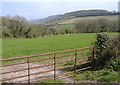


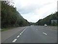


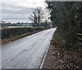
32 photos from this area
Area Information
Key information about the NP18 2NU including its size, population, and administrative classification.
- Area Type
- Postcode
- Area Size
- 1.4 hectares
- Population
- 2179
- Population Density
- 789 people/km²
House Prices in NP18 2NU
19
Properties
£278,699
Average Sold Price
£135,500
Lowest Price
£520,000
Highest Price
Showing 19 properties
| Address | Type | Beds | Baths | Last Sale Price | Last Sale Date | |
|---|---|---|---|---|---|---|
| 15 Silure Way, Langstone, Newport, NP18 2NU | Detached | 4 | 1 | £320,000 | Aug 2023 | |
| 16 Silure Way, Langstone, Newport, NP18 2NU | Detached | 4 | 1 | £269,000 | Oct 2018 | |
| 1 Silure Way, Langstone, Newport, NP18 2NU | house | - | - | £490,000 | Feb 2018 | |
| 4 Silure Way, Langstone, Newport, NP18 2NU | Detached | 5 | 3 | £520,000 | Oct 2017 | |
| 12 Silure Way, Langstone, Newport, NP18 2NU | Detached | 5 | 3 | £294,000 | Jun 2015 | |
| Llamedos, 10 Silure Way, Langstone, Newport, NP18 2NU | Detached | 3 | 2 | £208,500 | Nov 2014 | |
| 7 Silure Way, Langstone, Newport, NP18 2NU | Detached | - | - | £230,000 | Feb 2010 | |
| 6 Silure Way, Langstone, Newport, NP18 2NU | Detached | - | - | £450,000 | Feb 2008 | |
| 11 Silure Way, Langstone, Newport, NP18 2NU | Detached | - | - | £237,500 | Jan 2007 | |
| 20 Silure Way, Langstone, Newport, NP18 2NU | Detached | - | - | £208,000 | Oct 2006 |
Page 1 of 2
Energy Efficiency in NP18 2NU
Amenities
Schools
| Rank | School | Type | Entry gender | Ages |
|---|
Explore more schools in this area
Go to Schools tabDemographics
Household Size
Family (3-5 people)
most common
Accommodation Type
Houses
most common
Tenure
89
majority
Ethnic Group
White
most common
Religion
N/A
most common
Household Composition
N/A
most common
Age
47
median
Adults (30-64 years)
most common
Household Deprivation
N/A
with no deprivation
NS-SEC
47
in Lower managerial occupations
Explore more demographic insights in this area
Go to Demographics tabPlanning
Planning Constraints
- Flood RiskPremium
- Ramsar Wetland SitesPremium
- Area of Outstanding Natural BeautyPremium
- Protected Nature ReservePremium
- Protected WoodlandPremium
- Crime RiskPremium