Area Overview for NP18 2NS
Photos of NP18 2NS


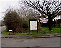
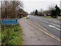
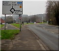


79 photos from this area
Area Information
Key information about the NP18 2NS including its size, population, and administrative classification.
- Area Type
- Postcode
- Area Size
- 1.3 hectares
- Population
- 2179
- Population Density
- 789 people/km²
House Prices in NP18 2NS
18
Properties
£228,637
Average Sold Price
£104,995
Lowest Price
£460,000
Highest Price
Showing 18 properties
| Address | Type | Beds | Baths | Last Sale Price | Last Sale Date | |
|---|---|---|---|---|---|---|
| 21 Stockwood View, Langstone, Newport, NP18 2NS | Detached | 4 | 2 | £420,000 | Jul 2025 | |
| Mulberry House, 14 Stockwood View, Langstone, Newport, NP18 2NS | Detached | 4 | 2 | £460,000 | Nov 2024 | |
| 11 Stockwood View, Langstone, Newport, NP18 2NS | Detached | 6 | 3 | £320,000 | Aug 2019 | |
| 17 Stockwood View, Langstone, Newport, NP18 2NS | Detached | 5 | - | £320,000 | Feb 2018 | |
| 1 Stockwood View, Langstone, Newport, NP18 2NS | Detached | 4 | 2 | £265,000 | Jul 2017 | |
| 10 Stockwood View, Langstone, Newport, NP18 2NS | house | - | - | £240,000 | Jul 2015 | |
| 13 Stockwood View, Langstone, Newport, NP18 2NS | house | - | - | £275,000 | Apr 2014 | |
| 5 Stockwood View, Langstone, Newport, NP18 2NS | Detached | 4 | 2 | £250,000 | Mar 2013 | |
| 19 Stockwood View, Langstone, Newport, NP18 2NS | house | - | - | £243,000 | Nov 2008 | |
| 12 Stockwood View, Langstone, Newport, NP18 2NS | Detached | - | - | £192,500 | Apr 2003 |
Page 1 of 2
Energy Efficiency in NP18 2NS
Amenities
Schools
| Rank | School | Type | Entry gender | Ages |
|---|
Explore more schools in this area
Go to Schools tabDemographics
Household Size
Family (3-5 people)
most common
Accommodation Type
Houses
most common
Tenure
89
majority
Ethnic Group
White
most common
Religion
N/A
most common
Household Composition
N/A
most common
Age
47
median
Adults (30-64 years)
most common
Household Deprivation
N/A
with no deprivation
NS-SEC
47
in Lower managerial occupations
Explore more demographic insights in this area
Go to Demographics tabPlanning
Planning Constraints
- Flood RiskPremium
- Ramsar Wetland SitesPremium
- Area of Outstanding Natural BeautyPremium
- Protected Nature ReservePremium
- Protected WoodlandPremium
- Crime RiskPremium