Area Overview for NP18 2NQ
Photos of NP18 2NQ

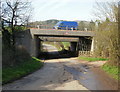
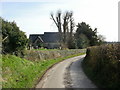

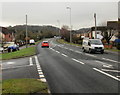

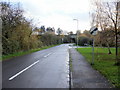

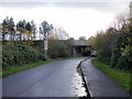


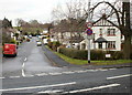
70 photos from this area
Area Information
Key information about the NP18 2NQ including its size, population, and administrative classification.
- Area Type
- Postcode
- Area Size
- 5.0 hectares
- Population
- 2179
- Population Density
- 789 people/km²
House Prices in NP18 2NQ
56
Properties
£190,575
Average Sold Price
£82,950
Lowest Price
£362,000
Highest Price
Showing 56 properties
| Address | Type | Beds | Baths | Last Sale Price | Last Sale Date | |
|---|---|---|---|---|---|---|
| 22 Court Meadow, Langstone, Newport, NP18 2NQ | Detached | 3 | 2 | £320,000 | Apr 2025 | |
| 17 Court Meadow, Langstone, Newport, NP18 2NQ | Detached | 3 | 2 | £305,000 | Feb 2025 | |
| 54 Court Meadow, Langstone, Newport, NP18 2NQ | Detached | 4 | 3 | £345,000 | Jun 2024 | |
| 56 Court Meadow, Langstone, Newport, NP18 2NQ | Detached | 3 | 2 | £345,000 | Mar 2023 | |
| 45 Court Meadow, Langstone, Newport, NP18 2NQ | Detached | 3 | 2 | £330,000 | Jan 2023 | |
| 26 Court Meadow, Langstone, Newport, NP18 2NQ | house | - | - | £299,950 | Sep 2021 | |
| 28 Court Meadow, Langstone, Newport, NP18 2NQ | house | - | - | £362,000 | Jun 2021 | |
| 14 Court Meadow, Langstone, Newport, NP18 2NQ | Detached | 3 | 2 | £265,000 | Feb 2019 | |
| 34 Court Meadow, Langstone, Newport, NP18 2NQ | Detached | 4 | 2 | £288,000 | Nov 2017 | |
| 5 Court Meadow, Langstone, Newport, NP18 2NQ | Detached | 4 | 1 | £282,500 | Oct 2017 |
Page 1 of 6
Energy Efficiency in NP18 2NQ
Amenities
Schools
| Rank | School | Type | Entry gender | Ages |
|---|
Explore more schools in this area
Go to Schools tabDemographics
Household Size
Family (3-5 people)
most common
Accommodation Type
Houses
most common
Tenure
89
majority
Ethnic Group
White
most common
Religion
N/A
most common
Household Composition
N/A
most common
Age
47
median
Adults (30-64 years)
most common
Household Deprivation
N/A
with no deprivation
NS-SEC
47
in Lower managerial occupations
Explore more demographic insights in this area
Go to Demographics tabPlanning
Planning Constraints
- Flood RiskPremium
- Ramsar Wetland SitesPremium
- Area of Outstanding Natural BeautyPremium
- Protected Nature ReservePremium
- Protected WoodlandPremium
- Crime RiskPremium