Area Overview for NP18 2BG
Photos of NP18 2BG

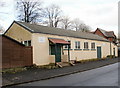
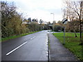
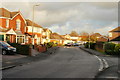
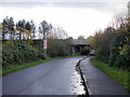
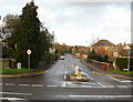
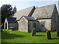
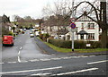
70 photos from this area
Area Information
Key information about the NP18 2BG including its size, population, and administrative classification.
- Area Type
- Postcode
- Area Size
- 1.8 hectares
- Population
- 2179
- Population Density
- 789 people/km²
House Prices in NP18 2BG
26
Properties
£220,902
Average Sold Price
£78,995
Lowest Price
£390,000
Highest Price
Showing 26 properties
| Address | Type | Beds | Baths | Last Sale Price | Last Sale Date | |
|---|---|---|---|---|---|---|
| 3 Grenadier Drive, Langstone, Newport, NP18 2BG | house | - | - | £320,000 | Sep 2021 | |
| 20 Grenadier Drive, Langstone, Newport, NP18 2BG | house | - | - | £255,000 | Mar 2021 | |
| 8 Grenadier Drive, Langstone, Newport, NP18 2BG | Detached | 4 | 2 | £390,000 | Mar 2021 | |
| 2 Grenadier Drive, Langstone, Newport, NP18 2BG | Detached | 4 | - | £375,000 | Oct 2020 | |
| 22 Grenadier Drive, Langstone, Newport, NP18 2BG | Detached | 4 | 1 | £240,000 | Mar 2020 | |
| 14 Grenadier Drive, Langstone, Newport, NP18 2BG | Detached | 4 | 2 | £321,000 | Feb 2020 | |
| 26 Grenadier Drive, Langstone, Newport, NP18 2BG | house | - | - | £218,500 | Jan 2018 | |
| 15 Grenadier Drive, Langstone, Newport, NP18 2BG | Detached | 4 | - | £264,950 | May 2016 | |
| 1 Grenadier Drive, Langstone, Newport, NP18 2BG | Detached | 4 | - | £232,500 | Jul 2015 | |
| 11 Grenadier Drive, Langstone, Newport, NP18 2BG | house | - | - | £222,000 | Aug 2014 |
Page 1 of 3
Energy Efficiency in NP18 2BG
Amenities
Schools
| Rank | School | Type | Entry gender | Ages |
|---|
Explore more schools in this area
Go to Schools tabDemographics
Household Size
Family (3-5 people)
most common
Accommodation Type
Houses
most common
Tenure
89
majority
Ethnic Group
White
most common
Religion
N/A
most common
Household Composition
N/A
most common
Age
47
median
Adults (30-64 years)
most common
Household Deprivation
N/A
with no deprivation
NS-SEC
47
in Lower managerial occupations
Explore more demographic insights in this area
Go to Demographics tabPlanning
Planning Constraints
- Flood RiskPremium
- Ramsar Wetland SitesPremium
- Area of Outstanding Natural BeautyPremium
- Protected Nature ReservePremium
- Protected WoodlandPremium
- Crime RiskPremium