Area Overview for NP10 8YD
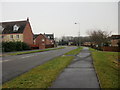
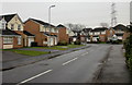
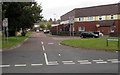
Photos of NP10 8YD


Area Information
Living in NP10 8YD means residing within a compact residential cluster covering only 5.2 hectares in south Wales. This small footprint concentrates a population of 1,703 residents, creating an intimate neighbourhood where neighbours are often close by yet maintain a degree of privacy. The area represents a specific postcode sector rather than a large town or urban centre, which defines the daily rhythm of local life. Residents enjoy a sense of community that comes from limited scale, while still benefiting from proximity to the wider Newport infrastructure. The location offers a quiet environment suitable for families and professionals seeking a settled lifestyle without the congestion of the city centre. Daily life here revolves around the immediate surroundings and reliable access to transport links just beyond the gate. You will find a stable community atmosphere where people tend to put down roots for the long term. The high density of 33,013 people per square kilometre indicates that despite the small land area, the development is reasonably built-up. This clustering effect means you do not need to travel far for the most essential local interactions. The area stands as a distinct residential zone that balances seclusion with accessibility to broader regional amenities. It is a place defined by its concentration of homes and the quiet confidence of established occupants.
- Area Type
- Postcode
- Area Size
- 5.2 hectares
- Population
- 1703
- Population Density
- 2187 people/km²
The property market in NP10 8YD is characterised by a predominantly owner-occupied landscape. With 75% of households in ownership, the area functions mainly as a residential settlement for people who have already secured their finances or inherited property assets. This contrasts with growing rental markets seen in many other parts of the country. The accommodation type is exclusively houses, meaning buyers looking for apartments or flats will not find them within this specific postcode boundary. If you are searching for a home here, you are looking towards the family sector or larger occupancy units typical of suburban house stocks. Buying into this area offers a straightforward transaction for owner-occupiers rather than landlords seeking investment rentals. The small size of the area, covering just 5.2 hectares, limits the volume of active sales but increases the value of individual properties due to scarcity. High ownership rates often correlate with better maintained exteriors and gardens, as owners have a longer-term stake in the upkeep of their homes. You will not encounter the churn of short-term lets or property flipping that sometimes plagues investor-heavy zones. Instead, the streets tend to feature established gardens and mature homes. Prospective buyers should expect a market driven by local need and stability rather than speculative growth. The housing stock remains static in type, focusing on detached and semi-detached structures suitable for permanent residence.
House Prices in NP10 8YD
Showing 3 properties
| Address | Type | Beds | Baths | Last Sale Price | Last Sale Date | |
|---|---|---|---|---|---|---|
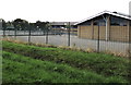
| Welsh Water, Pumping Station Opposite Duffryn High School, Lighthouse Road, Newport, NP10 8YD | education | - | - | - | - | |
| Duffryn Community Sports Centre, Lighthouse Road, Newport, NP10 8YD | Leisure | - | - | - | - | |
| Photovoltaic Installation Two At Sports Hall The John Frost School, Lighthouse Road, Newport, NP10 8YD | Industrial | - | - | - | - |
Energy Efficiency in NP10 8YD
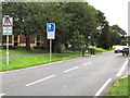
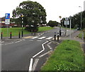
Your lifestyle in NP10 8YD is shaped by proximity to key retail and travel hubs that lie just outside the immediate boundary. You can access five major retail outlets, including Asda Newport, Heron Maesglas, and Iceland Newport. These supermarkets and shops are all reachable within a short drive or a comfortable walk depending on your specific location within the cluster. This access means you can handle weekly shopping and daily errands without needing to travel into the city centre. Beyond shopping, the area offers unique transport lifestyle benefits via the ferry terminal at Newport Ferry Terminal. This amenity provides a genuine maritime experience and alternative commuting route that you cannot find in most cities. Rail travel adds further variety to your weekly routine with stations like Rogerstone and Pye Corner available for your use. These stations connect you to the wider region without requiring a car for significant journeys. You also benefit from the convenience of Iceland for quick grocery runs, saving time on your busy week. The blend of heavy retail and coastal transport creates a balanced environment where domestic life meets regional connectivity. You will find that essential services cluster around these accessible points, reducing the need for long drives. The area supports a lifestyle where residents enjoy the convenience of urban-style shopping while maintaining the quieter pace of a residential cluster.
Amenities
Schools
Families living in NP10 8YD have access to two nearby educational institutions which serve the broader educational needs of the region. The closest option is The John Frost School, which functions as a non-maintained or specialist provision situated near the area. Another key facility is Ysgol Gyfun Gwent Is Coed, representing further non-maintained schooling options for children in the vicinity. Both institutions fall under the 'other' category in current records, indicating they may not be standard community primary or secondary schools typical of every neighbourhood. While standard primary and secondary data such as Ofsted ratings are not included in the records for these specific schools, their presence confirms immediate educational access. The concentration of non-maintained schools suggests that many local children may travel to comprehensive academies or city-run institutions outside these immediate gates. You should verify the specific admission criteria for both The John Frost School and Ysgol Gyfun Gwent Is Coed when planning for your children's education. The availability of these schools within practical reach means you do not need to commute far for specialized or alternative education pathways. This mix of school types provides flexibility for parents who value different educational approaches. However, the absence of standard feeder primary schools means older children in the 30-to-64 age bracket have the primary influence on school choice here.
| Rank | School | Type | Entry gender | Ages |
|---|
Explore more schools in this area
Go to Schools tabDemographics
The community profile of NP10 8YD reflects a mature population with a median age of 47 years. Most residents fall within the adult age range of 30 to 64 years, suggesting a population of established families or professionals in mid-career stages. This age distribution points toward a neighbourhood with stability and long-term residency patterns rather than transient populations. Home ownership stands at a striking 75%, indicating that the vast majority of occupants own their properties outright or have significant equity. This high level of ownership typically supports steady house prices and a strong sense of neighbourhood investment. Housing stock consists predominantly of houses, which aligns with the preferences of families and older residents seeking garden space and separate living areas. You will find little in the way of purpose-built flats or modern apartment blocks within this specific cluster. The ethnic makeup is primarily White, characterising a traditional demographic profile common in parts of south Wales. There are no indications of significant deprivation affecting the quality of life in this sector according to the available data. The combination of high ownership rates and a mature age cohort creates a quiet, settled environment. Residents often prioritise stability over rapid change, fostering a predictable and secure local culture.
Household Size
Accommodation Type
Tenure
Ethnic Group
Religion
Household Composition
Age
Household Deprivation
NS-SEC
Explore more demographic insights in this area
Go to Demographics tabPlanning
Planning Constraints
- Flood RiskPremium
- Ramsar Wetland SitesPremium
- Area of Outstanding Natural BeautyPremium
- Protected Nature ReservePremium
- Protected WoodlandPremium
- Crime RiskPremium