Area Overview for NP10 8TB
Photos of NP10 8TB
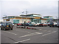

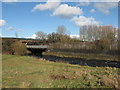
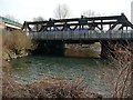
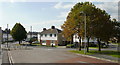


89 photos from this area
Area Information
Key information about the NP10 8TB including its size, population, and administrative classification.
- Area Type
- Postcode
- Area Size
- 59.0 hectares
- Population
- 1526
- Population Density
- 95 people/km²
House Prices in NP10 8TB
66
Properties
£111,293
Average Sold Price
£20,750
Lowest Price
£225,000
Highest Price
Showing 66 properties
| Address | Type | Beds | Baths | Last Sale Price | Last Sale Date | |
|---|---|---|---|---|---|---|
| 60 Beech Grove, Duffryn, Newport, NP10 8TB | Semi-detached | 3 | 1 | £215,000 | Jun 2025 | |
| 20 Beech Grove, Duffryn, Newport, NP10 8TB | Terraced | 2 | 1 | £180,000 | May 2025 | |
| 26 Beech Grove, Duffryn, Newport, NP10 8TB | Semi-detached | 2 | 1 | £170,000 | Jan 2025 | |
| 66 Beech Grove, Duffryn, Newport, NP10 8TB | Terraced | 2 | 1 | £190,000 | Nov 2024 | |
| 17 Beech Grove, Duffryn, Newport, NP10 8TB | Semi-detached | 2 | 1 | £170,000 | Sep 2024 | |
| 59 Beech Grove, Duffryn, Newport, NP10 8TB | Semi-detached | 3 | 1 | £225,000 | Aug 2024 | |
| 65 Beech Grove, Duffryn, Newport, NP10 8TB | Terraced | 2 | 1 | £140,000 | Aug 2024 | |
| 27 Beech Grove, Duffryn, Newport, NP10 8TB | house | 2 | 1 | £141,500 | Mar 2024 | |
| 25 Beech Grove, Duffryn, Newport, NP10 8TB | Terraced | 2 | 1 | £148,500 | Feb 2024 | |
| 33 Beech Grove, Duffryn, Newport, NP10 8TB | Terraced | 2 | 1 | £130,000 | Oct 2023 |
Page 1 of 7
Energy Efficiency in NP10 8TB
Amenities
Schools
| Rank | School | Type | Entry gender | Ages |
|---|
Explore more schools in this area
Go to Schools tabDemographics
Household Size
Two person
most common
Accommodation Type
Houses
most common
Tenure
85
majority
Ethnic Group
White
most common
Religion
N/A
most common
Household Composition
N/A
most common
Age
47
median
Adults (30-64 years)
most common
Household Deprivation
N/A
with no deprivation
NS-SEC
37
in Lower managerial occupations
Explore more demographic insights in this area
Go to Demographics tabPlanning
Planning Constraints
- Flood RiskPremium
- Ramsar Wetland SitesPremium
- Area of Outstanding Natural BeautyPremium
- Protected Nature ReservePremium
- Protected WoodlandPremium
- Crime RiskPremium