Area Overview for NP10 8SQ
Photos of NP10 8SQ
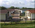
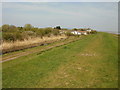
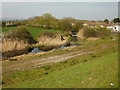
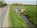
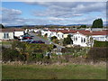

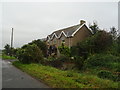

58 photos from this area
Area Information
Key information about the NP10 8SQ including its size, population, and administrative classification.
- Area Type
- Postcode
- Area Size
- 2.8 km²
- Population
- 1526
- Population Density
- 95 people/km²
House Prices in NP10 8SQ
34
Properties
£294,500
Average Sold Price
£65,000
Lowest Price
£620,000
Highest Price
Showing 34 properties
| Address | Type | Beds | Baths | Last Sale Price | Last Sale Date | |
|---|---|---|---|---|---|---|
| Rehoboth Cottage, Coast Road, St Brides Wentlooge, Newport, NP10 8SQ | Cottage | 1 | - | £230,000 | Jun 2021 | |
| Grey House Farm, Coast Road, St Brides Wentlooge, Newport, NP10 8SQ | Semi-detached | 4 | 2 | £620,000 | Feb 2021 | |
| Pistyll House, Nellive Park, St Brides Wentlooge, Newport, NP10 8SQ | Unknown | - | - | £209,000 | Jan 2019 | |
| Hartland, Church Road, St Brides Wentlooge, Newport, NP10 8SQ | Detached | 4 | 2 | £213,000 | Dec 2014 | |
| Tithe Barn, Church Road, St Brides Wentlooge, Newport, NP10 8SQ | Detached | - | - | £430,000 | Aug 2004 | |
| Holly House, Coast Road, St Brides Wentlooge, Newport, NP10 8SQ | house | - | - | £65,000 | Jan 2004 | |
| Westville, Church Road, St Brides Wentlooge, Newport, NP10 8SQ | Detached | 4 | 3 | - | - | |
| Church Farm House, Church Farm, Church Road, St Brides Wentlooge, Newport, NP10 8SQ | Land | - | - | - | - | |
| Church View, Church Road, St Brides Wentlooge, Newport, NP10 8SQ | Detached | 4 | 2 | - | - | |
| Elm Tree Farm, Coast Road, St Brides Wentlooge, Newport, NP10 8SQ | Detached | 9 | - | - | - |
Page 1 of 4
Energy Efficiency in NP10 8SQ
Amenities
Schools
| Rank | School | Type | Entry gender | Ages |
|---|
Explore more schools in this area
Go to Schools tabDemographics
Household Size
Two person
most common
Accommodation Type
Houses
most common
Tenure
85
majority
Ethnic Group
White
most common
Religion
N/A
most common
Household Composition
N/A
most common
Age
47
median
Adults (30-64 years)
most common
Household Deprivation
N/A
with no deprivation
NS-SEC
37
in Lower managerial occupations
Explore more demographic insights in this area
Go to Demographics tabPlanning
Planning Constraints
- Flood RiskPremium
- Ramsar Wetland SitesPremium
- Area of Outstanding Natural BeautyPremium
- Protected Nature ReservePremium
- Protected WoodlandPremium
- Crime RiskPremium