Area Overview for NP10 8LF
Photos of NP10 8LF

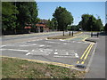
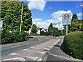
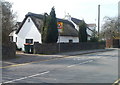
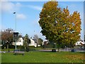
66 photos from this area
Area Information
Key information about the NP10 8LF including its size, population, and administrative classification.
- Area Type
- Postcode
- Area Size
- 1.7 hectares
- Population
- 2129
- Population Density
- 1702 people/km²
House Prices in NP10 8LF
15
Properties
£239,722
Average Sold Price
£60,000
Lowest Price
£430,000
Highest Price
Showing 15 properties
| Address | Type | Beds | Baths | Last Sale Price | Last Sale Date | |
|---|---|---|---|---|---|---|
| 40 Caerphilly Road, Newport, NP10 8LF | Semi-detached | 3 | 1 | £305,000 | Jan 2025 | |
| 48 Caerphilly Road, Newport, NP10 8LF | Semi-detached | 3 | 1 | £185,000 | Mar 2024 | |
| 29 Caerphilly Road, Newport, NP10 8LF | Detached | 5 | 2 | £385,000 | Jun 2017 | |
| 27 Caerphilly Road, Newport, NP10 8LF | Detached | - | - | £430,000 | Feb 2016 | |
| 31 Caerphilly Road, Newport, NP10 8LF | Detached | 5 | 2 | £330,000 | May 2014 | |
| 50 Caerphilly Road, Newport, NP10 8LF | house | - | - | £246,000 | May 2013 | |
| 44 Caerphilly Road, Newport, NP10 8LF | house | - | - | £137,500 | May 2010 | |
| 46 Caerphilly Road, Newport, NP10 8LF | Semi-detached | 3 | 1 | £60,000 | Aug 2002 | |
| 23 Caerphilly Road, Newport, NP10 8LF | Semi-detached | - | - | £79,000 | Apr 1998 | |
| 38 Caerphilly Road, Newport, NP10 8LF | Semi-detached | - | - | - | - |
Page 1 of 2
Energy Efficiency in NP10 8LF
Amenities
Schools
| Rank | School | Type | Entry gender | Ages |
|---|
Explore more schools in this area
Go to Schools tabDemographics
Household Size
Family (3-5 people)
most common
Accommodation Type
Houses
most common
Tenure
76
majority
Ethnic Group
White
most common
Religion
N/A
most common
Household Composition
N/A
most common
Age
47
median
Adults (30-64 years)
most common
Household Deprivation
N/A
with no deprivation
NS-SEC
44
in Lower managerial occupations
Explore more demographic insights in this area
Go to Demographics tabPlanning
Planning Constraints
- Flood RiskPremium
- Ramsar Wetland SitesPremium
- Area of Outstanding Natural BeautyPremium
- Protected Nature ReservePremium
- Protected WoodlandPremium
- Crime RiskPremium