Area Overview for NP10 8NF
Photos of NP10 8NF

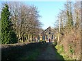
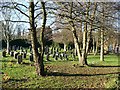
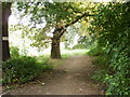
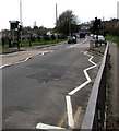
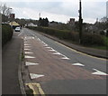
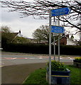
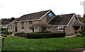
66 photos from this area
Area Information
Key information about the NP10 8NF including its size, population, and administrative classification.
- Area Type
- Postcode
- Area Size
- 7.9 hectares
- Population
- 2129
- Population Density
- 1702 people/km²
House Prices in NP10 8NF
19
Properties
£348,704
Average Sold Price
£117,000
Lowest Price
£590,000
Highest Price
Showing 19 properties
| Address | Type | Beds | Baths | Last Sale Price | Last Sale Date | |
|---|---|---|---|---|---|---|
| 12 Forge Lane, Bassaleg, Newport, NP10 8NF | Detached | 4 | 3 | £575,000 | Feb 2025 | |
| 7 Forge Lane, Bassaleg, Newport, NP10 8NF | Detached | 3 | 3 | £515,000 | Jan 2024 | |
| 5 Forge Lane, Bassaleg, Newport, NP10 8NF | Detached | 4 | 1 | £590,000 | Jan 2023 | |
| 15 Forge Lane, Bassaleg, Newport, NP10 8NF | house | - | - | £435,000 | Apr 2019 | |
| 6 Forge Lane, Bassaleg, Newport, NP10 8NF | Detached | 4 | 2 | £460,000 | Oct 2018 | |
| 10 Forge Lane, Bassaleg, Newport, NP10 8NF | house | - | - | £343,000 | Feb 2016 | |
| 13 Forge Lane, Bassaleg, Newport, NP10 8NF | Detached | 4 | - | £250,000 | Jan 2014 | |
| 9 Forge Lane, Bassaleg, Newport, NP10 8NF | Detached | - | - | £337,500 | Jun 2004 | |
| 16 Forge Lane, Bassaleg, Newport, NP10 8NF | Detached | - | - | £269,950 | May 2002 | |
| 8 Forge Lane, Bassaleg, Newport, NP10 8NF | Detached | - | - | £172,000 | Jul 2001 |
Page 1 of 2
Energy Efficiency in NP10 8NF
Amenities
Schools
| Rank | School | Type | Entry gender | Ages |
|---|
Explore more schools in this area
Go to Schools tabDemographics
Household Size
Family (3-5 people)
most common
Accommodation Type
Houses
most common
Tenure
76
majority
Ethnic Group
White
most common
Religion
N/A
most common
Household Composition
N/A
most common
Age
47
median
Adults (30-64 years)
most common
Household Deprivation
N/A
with no deprivation
NS-SEC
44
in Lower managerial occupations
Explore more demographic insights in this area
Go to Demographics tabPlanning
Planning Constraints
- Flood RiskPremium
- Ramsar Wetland SitesPremium
- Area of Outstanding Natural BeautyPremium
- Protected Nature ReservePremium
- Protected WoodlandPremium
- Crime RiskPremium