Area Overview for SA11 4NH
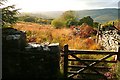
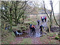
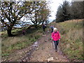
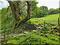
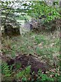
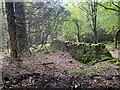
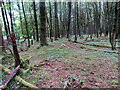
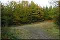
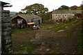
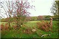
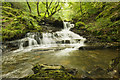
Photos of SA11 4NH

Area Information
Living in SA11 4NH means residing in a specific postcode area covering a small residential cluster in Wales. You are part of a defined territory measuring just 98.6 hectares, which translates to a population density of 73 people per square kilometre. This low density creates a quiet environment where residents enjoy spacious surroundings rather than crowded streets. The community feels intimate because only 1,345 people call this specific location home. You will find that daily life revolves around a tight-knit neighbourhood where neighbours likely know each other personally. The area functions as a self-contained living space where the scale is manageable and community interaction is natural. Prospective buyers seeking a secluded yet accessible spot in South Wales will find this setting distinct from larger urban centres. The layout supports a slower pace of life without isolating you from essential services outside the immediate boundary. When you look at property in SA11 4NH, you are entering a space defined by its compact size and resident-focused design. The environment caters to those who value tranquility over city noise.
- Area Type
- Postcode
- Area Size
- 98.6 hectares
- Population
- 1345
- Population Density
- 73 people/km²
The property market in SA11 4NH is distinctly characterised by a housing stock dominated by houses rather than flats or apartments. A staggering 78% of homes in this postcode are owner-occupied, meaning the rental market is a very small segment of the total supply. This statistic indicates that families and individuals prefer to buy into the area rather than rent. If you search for homes in SA11 4NH, your options will primarily be traditional detached or semi-detached properties suited to long-term living. The market is not driven by high-yield rentals or student accommodation but by people who intend to stay, often bringing children or working from home. This stability suggests property values are tied to neighbourhood quality rather than speculative investment trends. Because the area consists almost entirely of houses, you will not find purpose-built apartment blocks to consider. The scarcity of rental inventories makes purchasing the only viable route for most serious buyers. This owner-led market creates a sense of permanence and reduces the turnover rate found in newer, more transient developments.
House Prices in SA11 4NH
Showing 22 properties
| Address | Type | Beds | Baths | Last Sale Price | Last Sale Date | |
|---|---|---|---|---|---|---|
| 14 Pentwyn Road, Resolven, SA11 4NH | Detached | 3 | 1 | £206,500 | May 2025 | |
| 3 Pentwyn Road, Resolven, SA11 4NH | house | 4 | - | £157,000 | Dec 2018 | |
| Tyla Glas, 16 Pentwyn Road, Resolven, SA11 4NH | Detached | - | - | £250,000 | Jul 2005 | |
| 11 Pentwyn Road, Resolven, SA11 4NH | Semi-detached | - | - | £33,000 | Jul 1999 | |
| 12 Pentwyn Road, Resolven, SA11 4NH | Detached | - | - | £40,000 | Jan 1999 | |
| 13 Pentwyn Road, Resolven, SA11 4NH | Detached | - | - | £51,000 | Jun 1997 | |
| 3A Pentwyn Road, Resolven, SA11 4NH | Detached | 5 | 1 | - | - | |
| 2 Pentwyn Road, Resolven, SA11 4NH | Semi-detached | - | - | - | - | |
| Pentwyn Farmhouse, Pentwyn Farm, Pentwyn Road, Resolven, SA11 4NH | Detached | - | - | - | - | |
| 4 Pentwyn Road, Resolven, SA11 4NH | Detached | - | - | - | - |
Energy Efficiency in SA11 4NH
Your lifestyle in SA11 4NH is shaped by proximity to key retail and transport hubs just outside the immediate boundary. You have five major retail options within practical reach, including the large Asda Neath, the Tesco Glynneath, and a local Spar for essential daily shopping. These venues provide everything from fresh groceries to larger supermarket runs without the need for a car trip to the city centre. For residents relying on public transport, Neath Railway Station is the single notable rail link available to you. This station provides access to broader travel networks, though you must plan your journeys carefully from this small postcode. The combination of these amenities means you do not need to sit on a rural estate entirely cut off from modern conveniences. You can visit the larger town centres for dining or leisure while returning to the quieter SA11 4NH environment. The arrangement supports a semi-rural lifestyle with urban accessibility, allowing you to maintain a balanced routine. However, do not expect a wide range of independent boutiques or specialised leisure centres within the 98.6 hectares itself.
Amenities
Schools
| Rank | School | Type | Entry gender | Ages |
|---|
Explore more schools in this area
Go to Schools tabDemographics
The community in SA11 4NH is defined by an older demographic profile with a median age of 47 years. Most residents fall within the adult age range of 30 to 64 years, indicating a workforce-dependent household structure rather than a retirement community. You will predominantly find established households here, as 78% of properties are owner-occupied. This high rate of home ownership suggests long-term residents who have invested in their local environment. Houses constitute the main accommodation type across the postcode, reinforcing the family-oriented and settled nature of the area. The predominant ethnic group is White, reflecting a homogeneous community composition. Demographic data shows that this is not a transient zone but a place where families and adults build lasting lives. The absence of young children under 30 means the area may lack the vibrant play streets of younger suburbs, while the concentration of middle-aged adults ensures a stable electorate and consistent community groups. You are buying into a settled demographic mix where neighbours have likely lived there for decades.
Household Size
Accommodation Type
Tenure
Ethnic Group
Religion
Household Composition
Age
Household Deprivation
NS-SEC
Explore more demographic insights in this area
Go to Demographics tabPlanning
Planning Constraints
- Flood RiskPremium
- Ramsar Wetland SitesPremium
- Area of Outstanding Natural BeautyPremium
- Protected Nature ReservePremium
- Protected WoodlandPremium
- Crime RiskPremium