Area Overview for SA11 2TU
Photos of SA11 2TU


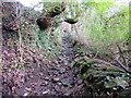
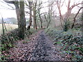
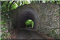
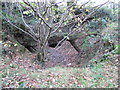
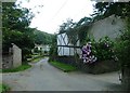
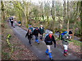
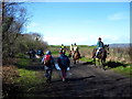


12 photos from this area
Area Information
Key information about the SA11 2TU including its size, population, and administrative classification.
- Area Type
- Postcode
- Area Size
- 16.3 hectares
- Population
- 1465
- Population Density
- 403 people/km²
House Prices in SA11 2TU
18
Properties
£284,125
Average Sold Price
£186,500
Lowest Price
£380,000
Highest Price
Showing 18 properties
| Address | Type | Beds | Baths | Last Sale Price | Last Sale Date | |
|---|---|---|---|---|---|---|
| Brynamlwg, 2 Pant Howell Ddu, Briton Ferry, SA11 2TU | Bungalow | 2 | 1 | £186,500 | Mar 2024 | |
| Brooklyn, 5 Pant Howell Ddu, Briton Ferry, SA11 2TU | Detached | 5 | - | £380,000 | Feb 2022 | |
| Birch Lodge, Pant Howell Ddu, Briton Ferry, SA11 2TU | Bungalow | 5 | 2 | £240,000 | Jul 2019 | |
| Penrhiw House, Pant Howell Ddu, Briton Ferry, SA11 2TU | Detached | 5 | 4 | £330,000 | Dec 2004 | |
| Hillside, 3 Pant Howell Ddu, Briton Ferry, SA11 2TU | Bungalow | 2 | 1 | - | - | |
| Tyla Morris House, Pant Howell Ddu, Briton Ferry, SA11 2TU | Land | - | - | - | - | |
| The Coach House, Pant Howell Ddu, Briton Ferry, SA11 2TU | Detached | - | - | - | - | |
| New Bungalow, Pant Howell Ddu, Briton Ferry, SA11 2TU | Detached | - | - | - | - | |
| 1, Hollybrook, New Bungalows, Pant Howell Ddu, Briton Ferry, SA11 2TU | Detached | - | - | - | - | |
| Bryntawel, 4 Pant Howell Ddu, Briton Ferry, SA11 2TU | Detached | - | - | - | - |
Page 1 of 2
Energy Efficiency in SA11 2TU
Amenities
Schools
| Rank | School | Type | Entry gender | Ages |
|---|
Explore more schools in this area
Go to Schools tabDemographics
Household Size
One person
most common
Accommodation Type
Houses
most common
Tenure
71
majority
Ethnic Group
White
most common
Religion
N/A
most common
Household Composition
N/A
most common
Age
47
median
Adults (30-64 years)
most common
Household Deprivation
N/A
with no deprivation
NS-SEC
22
in Lower managerial occupations
Explore more demographic insights in this area
Go to Demographics tabPlanning
Planning Constraints
- Flood RiskPremium
- Ramsar Wetland SitesPremium
- Area of Outstanding Natural BeautyPremium
- Protected Nature ReservePremium
- Protected WoodlandPremium
- Crime RiskPremium