Area Overview for SA11 2TG
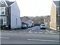
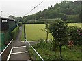
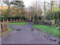
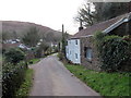
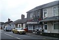
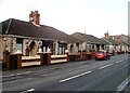
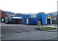
Photos of SA11 2TG

Area Information
Living in SA11 2TG means settling into a small residential cluster defined by specific boundaries and a defined residential population. This postcode occupies an area of exactly 3,680 square metres and houses a community of 1,465 residents. The population density stands at 403 people per square kilometre, creating a neighbourhood that feels manageable without excessive urban congestion. You are not looking at a sprawling district but a concentrated residential zone where neighbourhood dynamics are more immediate. Daily life here is shaped by the proximity of this tight-knit group of households rather than vast open spaces. The area represents a specific pocket within the wider Swansea landscape, catering to those who prefer to know their immediate surroundings. Understanding the sheer scale of this postcode helps frame expectations for property hunting. The physical footprint is compact, which often means shared local services and a strong sense of locality among the 1,465 people who call this spot home. When you consider buying a home here, you are entering a defined environment where every resident is part of a smaller, more familiar calculation of community residency.
- Area Type
- Postcode
- Area Size
- 3680 m²
- Population
- 1465
- Population Density
- 403 people/km²
The property market in SA11 2TG is characterised by a strong preference for ownership over renting. With 71 per cent of households being owner-occupied, the area functions as a traditional residential estate rather than a rental hotspot. Houses make up the primary accommodation type, suggesting that detached, semi-detached, or terraced family homes dominate the streetscapes. Buying homes in SA11 2TG means purchasing into an asset base held by local families. This high rate of ownership often correlates with stable property values and a condition of the stock that has been maintained by owners over time. The small area size of 3,680 square metres further constrains the market to a limited number of properties, making each listing significant. You are less likely to compete with investors looking for short-term lets and more likely to compete with other settled buyers. The accommodation style is consistent; you will not encounter a mix of luxury conversions or student accommodations. The market reflects the demographics of the 1,465 people living here: people who own their homes. When searching for homes in SA11 2TG, your pool of potential properties will align closely with this legacy of owner-occupation and estate housing.
House Prices in SA11 2TG
Showing 20 properties
| Address | Type | Beds | Baths | Last Sale Price | Last Sale Date | |
|---|---|---|---|---|---|---|
| 15 Ormond Street, Briton Ferry, SA11 2TG | Terraced | 3 | 1 | £159,960 | Jan 2022 | |
| 1A Ormond Street, Briton Ferry, SA11 2TG | house | 3 | - | £175,000 | Dec 2021 | |
| 1 Ormond Street, Briton Ferry, SA11 2TG | house | - | - | £130,000 | Aug 2017 | |
| 21 Ormond Street, Briton Ferry, SA11 2TG | Terraced | 3 | 1 | £85,000 | Apr 2017 | |
| 13 Ormond Street, Briton Ferry, SA11 2TG | Terraced | 2 | - | £91,000 | May 2016 | |
| 29 Ormond Street, Briton Ferry, SA11 2TG | Terraced | 3 | 1 | £116,000 | May 2014 | |
| 37 Ormond Street, Briton Ferry, SA11 2TG | Terraced | 4 | 2 | £121,000 | Apr 2010 | |
| 19 Ormond Street, Briton Ferry, SA11 2TG | Terraced | - | - | £114,000 | Sep 2007 | |
| 25 Ormond Street, Briton Ferry, SA11 2TG | house | - | - | £85,500 | Oct 2005 | |
| 27 Ormond Street, Briton Ferry, SA11 2TG | Terraced | - | - | £23,000 | Feb 2001 |
Energy Efficiency in SA11 2TG
Your daily lifestyle in SA11 2TG depends on accessing key amenities located just outside the residential cluster. You have access to five rail stations within practical reach, including Briton Ferry Railway Station, Neath Railway Station, and Baglan Railway Station. These stations link the area to the wider transport network. For shopping and everyday needs, you can utilise the retail hubs at Tesco Briton, Lidl Briton, and Tesco Neath. These supermarkets are the primary destinations for groceries and general household shopping. Commuters will appreciate the ferry connection available via Swansea Queens Dock Ferry Terminal, providing a direct link across the water. Living in SA11 2TG means you rely on these nearby facilities for your routine errands. You do not need to drive far to find essential services. The proximity of these three rail stations and three major retailers creates a convenient commercial radius. Your week will involve trips to the local Tesco stores or the Lidl outlet. Even if you live in a small area, the reach extends to significant transport and retail nodes. This blend of local and regional access defines the convenience factor for residents of this postcode.
Amenities
Schools
Families with school-age children will find Cwrt Sart Community Comprehensive School and Ysgol Carreg Hir within practical reach of their homes. Both institutions are categorised as other schools in the local education system. Living in SA11 2TG places you within the catchment or commuting zone of these specific educational establishments. You do not have data on the specific Ofsted ratings for these venues, so you must verify their current standing directly with the schools or the education authority. The presence of these two named institutions indicates that local families utilise existing facilities rather than awaiting distant transport to education. The mix of schools suggests a standard provision for secondary education within the local authority area. When you consider schools near SA11 2TG, these are the primary options listed for the immediate vicinity. You should research the specific curriculum offerings and age ranges of Cwrt Sart Community Comprehensive School and Ysgol Carreg Hir to ensure they meet your children's needs. The availability of nearby schools is a confirmed fact of the location, even without granular performance metrics provided in this dataset.
| Rank | School | Type | Entry gender | Ages |
|---|
Explore more schools in this area
Go to Schools tabDemographics
The community within SA11 2TG reflects a settled demographic profile dominated by adults. The median age of residents is 47 years old, indicating a population primarily composed of people aged between 30 and 64 years. This suggests the area functions as a family base or a retirement destination rather than a youthful student hub. Home ownership is the norm in this postcode, with 71 per cent of households owning their properties outright or with a mortgage. This high ownership rate points to long-term stability and settled residents who view the area as a permanent home. Houses form the predominant accommodation type, meaning you will find traditional residential structures rather than high-rise apartments or purpose-built flats. The predominant ethnic group is White, mirroring the broader demographic trends of the region. You do not find complex social housing blocks or transient populations here. Instead, the neighbourhood consists of established homeowners who have put down roots. This stability creates a predictable environment where local rules and customs are well understood by the majority. The age profile and ownership data combine to suggest a quiet, mature atmosphere where neighbours likely know each other well.
Household Size
Accommodation Type
Tenure
Ethnic Group
Religion
Household Composition
Age
Household Deprivation
NS-SEC
Explore more demographic insights in this area
Go to Demographics tabPlanning
Planning Constraints
- Flood RiskPremium
- Ramsar Wetland SitesPremium
- Area of Outstanding Natural BeautyPremium
- Protected Nature ReservePremium
- Protected WoodlandPremium
- Crime RiskPremium