Area Overview for SA11 2LE
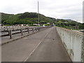
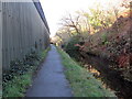
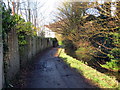
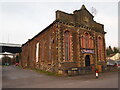
Photos of SA11 2LE


Area Information
Living in SA11 2LE means calling a compact residential cluster your home. This postcode covers an area of 9365 square metres and is situated within Wales. The demographic profile shows a population of 1601 people across this small footprint. You are looking at a population density of 1179 people per square kilometre, which indicates a tightly knit neighbourhood rather than a sprawling suburb. Most residents are adults between the ages of 30 and 64 years old. The area consists predominantly of houses, creating a setting that feels established and residential. With a mix of homeowners and renters, the community offers a stable environment for families settling down. The moderate density ensures that noise levels generally remain manageable while maintaining easy access to the wider region. This specific postcode is not a vast district but a focused residential zone where local services and transport links play a crucial role in daily life. You will find yourself in a location defined by its efficiency and proximity to larger towns rather than urban sprawl.
- Area Type
- Postcode
- Area Size
- 9365 m²
- Population
- 1601
- Population Density
- 1179 people/km²
The property market in SA11 2LE is characterised by a distinct housing stock focused on houses rather than flats. With a home ownership rate of 41%, there is a balanced split between private owners and tenants. This figure suggests that nearly two-thirds of the population rents their accommodation, which points to a flexible market suitable for movers and children attending local schools. The presence of houses as the primary accommodation type means that buyers will find traditional detached or semi-detached rather than high-rise living. This type of dwelling often appeals to families due to the presence of gardens and separate living spaces. The small size of the area, covering only 9365 square metres, limits the total number of properties available within the immediate postcode boundary. Consequently, interior and just outside the immediate block, options may be scarce. You must act quickly if you encounter a suitable listing, as inventory in such a concentrated area often moves fast. The market reflects a trade-off between local scarcity and the convenience of being in close proximity to transport hubs like the nearby rail stations. Buyers should prioritise quality over quantity in this setting.
House Prices in SA11 2LE
Showing 34 properties
| Address | Type | Beds | Baths | Last Sale Price | Last Sale Date | |
|---|---|---|---|---|---|---|
| 57 Brynhyfryd Road, Briton Ferry, SA11 2LE | Terraced | 3 | 1 | £125,000 | Jan 2025 | |
| 73 Brynhyfryd Road, Briton Ferry, SA11 2LE | Semi-detached | 2 | 1 | £118,000 | Dec 2024 | |
| 54 Brynhyfryd Road, Briton Ferry, SA11 2LE | house | 3 | - | £65,000 | Dec 2022 | |
| 58 Brynhyfryd Road, Briton Ferry, SA11 2LE | Terraced | 3 | 1 | £138,000 | Oct 2022 | |
| 65 Brynhyfryd Road, Briton Ferry, SA11 2LE | Flat | - | - | £160,000 | Jul 2021 | |
| 46 Brynhyfryd Road, Briton Ferry, SA11 2LE | Semi-detached | 3 | - | £87,000 | Jun 2006 | |
| 63 Brynhyfryd Road, Briton Ferry, SA11 2LE | Terraced | - | - | £39,950 | Aug 2002 | |
| 47 Brynhyfryd Road, Briton Ferry, SA11 2LE | Terraced | 3 | 1 | - | - | |
| 42 Brynhyfryd Road, Briton Ferry, SA11 2LE | Terraced | 3 | - | - | - | |
| Living Accommodation, 64 Brynhyfryd Road, Briton Ferry, SA11 2LE | Flat | - | - | - | - |
Energy Efficiency in SA11 2LE
Daily life in SA11 2LE benefits from practical amenities located just beyond the immediate residential cluster. Five rail stations serve the area, with Briton Ferry Railway Station, Baglan Railway Station, and Neath Railway Station being notable access points. This rail network connects you efficiently to the wider Swansea and Valleys region. For grocery shopping, you have five retail options within easy reach. Tesco Briton, Lidl Briton, and Morrisons Daily provide your weekly food needs without requiring long car journeys. Additionally, one ferry terminal is accessible, namely the Swansea Queens Dock Ferry Terminal. This option offers a unique route for travel or leisure trips to Ireland. The presence of these varied transport and commercial hubs means you do not need to live in the city centre to access major convenience stores. You can easily run errands locally or commute regionally depending on your needs. The lifestyle here is defined by the convenience of these specific named venues. It is a practical, self-sufficient neighbourhood supported by established retail and transport infrastructure.
Amenities
Schools
Families looking at SA11 2LE have access to one specific educational institution nearby. YGG Tyle'r Ynn is the only school listed in the immediate vicinity for this postcode. This facility operates as an 'other' type of school, which may refer to a specialist academy or a specific local education authority provision. Residents cannot rely on a wide variety of secondary or primary options within steps of their homes. The limited selection means that families must consider travel time or the availability of bus routes to reach larger educational centres in Neath or Swansea. Living in SA11 2LE requires prioritising educational logistics early in the house hunting process. The school count of one is surprisingly low for a residential population of 1601, suggesting most children in the wider SA11 area likely attend schools spread across the Brynglas and South Wales Valleys region. You cannot assume a traditional school catchment area exists within the immediate boundaries of this cluster. Prospective parents should verify transport links before committing to a property here.
| Rank | School | Type | Entry gender | Ages |
|---|
Explore more schools in this area
Go to Schools tabDemographics
The community in SA11 2LE is defined by a mature population structure. The median age is 47 years, indicating that residents are typically mid-career professionals or retirees seeking stability. The most common age range is adults from 30 to 64 years old, confirming that this area appeals to those establishing a permanent base rather than transient renters. Home ownership stands at 41%, meaning slightly less than half of the households own their property outright. The remaining residents likely reside in the significant rental market that complements the owner-occupied stock. Houses form the primary accommodation type, eliminating the urban density of flats or terraced blocks found in busier city centres. The predominant ethnic group within the area is White, though the neighbourhood still offers a standard representation of local diversity. There is a clear focus on family units and established households rather than single-person bookings. This demographic makeup suggests a quiet, reliable environment where neighbours tend to know one another. The steady age profile means you are joining a community with deep roots rather than a transient population.
Household Size
Accommodation Type
Tenure
Ethnic Group
Religion
Household Composition
Age
Household Deprivation
NS-SEC
Explore more demographic insights in this area
Go to Demographics tabPlanning
Planning Constraints
- Flood RiskPremium
- Ramsar Wetland SitesPremium
- Area of Outstanding Natural BeautyPremium
- Protected Nature ReservePremium
- Protected WoodlandPremium
- Crime RiskPremium