Area Overview for NP26 3PS
Photos of NP26 3PS
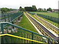
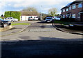
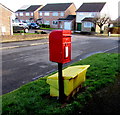
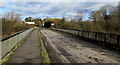
46 photos from this area
Area Information
Key information about the NP26 3PS including its size, population, and administrative classification.
- Area Type
- Postcode
- Area Size
- 8768 m²
- Population
- 1411
- Population Density
- 129 people/km²
House Prices in NP26 3PS
21
Properties
£168,047
Average Sold Price
£62,500
Lowest Price
£389,950
Highest Price
Showing 21 properties
| Address | Type | Beds | Baths | Last Sale Price | Last Sale Date | |
|---|---|---|---|---|---|---|
| 8 Badgers Walk, Undy, NP26 3PS | Detached | 4 | 2 | £389,950 | Apr 2023 | |
| 12 Badgers Walk, Undy, NP26 3PS | Semi-detached | 3 | 2 | £253,500 | May 2022 | |
| 14 Badgers Walk, Undy, NP26 3PS | house | - | - | £239,950 | May 2021 | |
| 16 Badgers Walk, Undy, NP26 3PS | house | - | - | £122,500 | Oct 2017 | |
| 21 Badgers Walk, Undy, NP26 3PS | house | - | - | £195,000 | Mar 2016 | |
| 5 Badgers Walk, Undy, NP26 3PS | house | 4 | - | £227,000 | Dec 2015 | |
| 6 Badgers Walk, Undy, NP26 3PS | Detached | 4 | 2 | £217,000 | Jun 2015 | |
| The Acorns, 9 Badgers Walk, Undy, NP26 3PS | Detached | 4 | 2 | £222,000 | Apr 2010 | |
| 4 Badgers Walk, Undy, NP26 3PS | Detached | - | - | £212,000 | Mar 2007 | |
| 3 Badgers Walk, Undy, NP26 3PS | Detached | - | - | £220,000 | Nov 2006 |
Page 1 of 3
Energy Efficiency in NP26 3PS
Amenities
Schools
| Rank | School | Type | Entry gender | Ages |
|---|
Explore more schools in this area
Go to Schools tabDemographics
Household Size
Two person
most common
Accommodation Type
Houses
most common
Tenure
89
majority
Ethnic Group
White
most common
Religion
N/A
most common
Household Composition
N/A
most common
Age
47
median
Adults (30-64 years)
most common
Household Deprivation
N/A
with no deprivation
NS-SEC
44
in Lower managerial occupations
Explore more demographic insights in this area
Go to Demographics tabPlanning
Planning Constraints
- Flood RiskPremium
- Ramsar Wetland SitesPremium
- Area of Outstanding Natural BeautyPremium
- Protected Nature ReservePremium
- Protected WoodlandPremium
- Crime RiskPremium