Area Overview for NP25 5SR
Photos of NP25 5SR
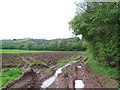
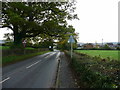

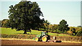

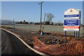

15 photos from this area
Area Information
Key information about the NP25 5SR including its size, population, and administrative classification.
- Area Type
- Postcode
- Area Size
- 57.4 hectares
- Population
- 1491
- Population Density
- 346 people/km²
House Prices in NP25 5SR
10
Properties
£328,938
Average Sold Price
£170,000
Lowest Price
£540,000
Highest Price
Showing 10 properties
| Address | Type | Beds | Baths | Last Sale Price | Last Sale Date | |
|---|---|---|---|---|---|---|
| Meadow View, Rockfield Road, Monmouth, NP25 5SR | Detached | 4 | 2 | £540,000 | Apr 2025 | |
| Laburnam Bungalow, Rockfield Road, Monmouth, NP25 5SR | Bungalow | 5 | 1 | £303,750 | Mar 2016 | |
| The Warren, Rockfield Road, Monmouth, NP25 5SR | Detached | 5 | - | £302,000 | Aug 2010 | |
| Brook Cottage, Rockfield Road, Monmouth, NP25 5SR | Detached | - | - | £170,000 | Sep 2006 | |
| Croft Y Bwla Farm, Rockfield Road, Monmouth, NP25 5SR | Bungalow | 3 | 1 | - | - | |
| Kingslea House, Croft Y Bwla Farm, Rockfield Road, Monmouth, NP25 5SR | house | - | - | - | - | |
| Collingwood, Rockfield Road, Monmouth, NP25 5SR | Bungalow | - | - | - | - | |
| Annexe, The Warren, Rockfield Road, Monmouth, NP25 5SR | Detached | - | - | - | - | |
| Drybridge Farm, Rockfield Road, Monmouth, NP25 5SR | Detached | - | - | - | - | |
| Croft Y Bwla Cottage, Rockfield Road, Monmouth, NP25 5SR | Bungalow | - | - | - | - |
Energy Efficiency in NP25 5SR
Amenities
Schools
| Rank | School | Type | Entry gender | Ages |
|---|
Explore more schools in this area
Go to Schools tabDemographics
Household Size
One person
most common
Accommodation Type
Houses
most common
Tenure
66
majority
Ethnic Group
White
most common
Religion
N/A
most common
Household Composition
N/A
most common
Age
47
median
Adults (30-64 years)
most common
Household Deprivation
N/A
with no deprivation
NS-SEC
30
in Lower managerial occupations
Explore more demographic insights in this area
Go to Demographics tabPlanning
Planning Constraints
- Flood RiskPremium
- Ramsar Wetland SitesPremium
- Area of Outstanding Natural BeautyPremium
- Protected Nature ReservePremium
- Protected WoodlandPremium
- Crime RiskPremium