Area Overview for NP25 4SE
Photos of NP25 4SE
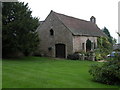
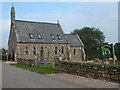

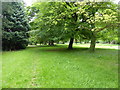
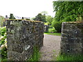

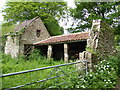

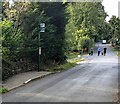
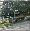
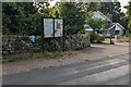
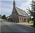
31 photos from this area
Area Information
Key information about the NP25 4SE including its size, population, and administrative classification.
- Area Type
- Postcode
- Area Size
- 54.3 hectares
- Population
- 1289
- Population Density
- 71 people/km²
House Prices in NP25 4SE
39
Properties
£413,269
Average Sold Price
£70,000
Lowest Price
£775,000
Highest Price
Showing 39 properties
| Address | Type | Beds | Baths | Last Sale Price | Last Sale Date | |
|---|---|---|---|---|---|---|
| Highview, Pentwyn Lane, Penallt, NP25 4SE | Bungalow | 3 | 1 | £530,000 | Aug 2025 | |
| Ty Bryn, Pentwyn Lane, Penallt, NP25 4SE | house | - | - | £715,000 | Apr 2025 | |
| The Old Baptist Chapel, Moorcroft Road, Penallt, NP25 4SE | house | - | - | £400,000 | Mar 2023 | |
| Capel Pentwyn, Pentwyn Lane, Penallt, NP25 4SE | house | - | - | £640,000 | Feb 2022 | |
| Penslade, Pentwyn Lane, Penallt, NP25 4SE | Bungalow | - | - | £441,000 | Mar 2020 | |
| Brenchley, Pentwyn Lane, Penallt, NP25 4SE | Bungalow | - | - | £480,000 | Sep 2019 | |
| Croes Faen House, Pentwyn Lane, Penallt, NP25 4SE | Detached | 4 | 2 | £598,000 | Apr 2019 | |
| The Orchard, Pentwyn Green, Penallt, NP25 4SE | Bungalow | 4 | 2 | £430,000 | Oct 2018 | |
| Little Pentwyn Farm, Pentwyn Lane, Penallt, NP25 4SE | house | - | - | £470,000 | Oct 2017 | |
| Pentwyn Court, Moorcroft Road, Penallt, NP25 4SE | Detached | 4 | - | £460,000 | Dec 2016 |
Page 1 of 4
Energy Efficiency in NP25 4SE
Amenities
Schools
| Rank | School | Type | Entry gender | Ages |
|---|
Explore more schools in this area
Go to Schools tabDemographics
Household Size
Two person
most common
Accommodation Type
Houses
most common
Tenure
93
majority
Ethnic Group
White
most common
Religion
N/A
most common
Household Composition
N/A
most common
Age
47
median
Adults (30-64 years)
most common
Household Deprivation
N/A
with no deprivation
NS-SEC
55
in Lower managerial occupations
Explore more demographic insights in this area
Go to Demographics tabPlanning
Planning Constraints
- Flood RiskPremium
- Ramsar Wetland SitesPremium
- Protected Nature ReservePremium
- Protected WoodlandPremium
- Crime RiskPremium