Area Overview for NP25 4SB
Photos of NP25 4SB
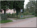
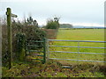
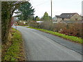
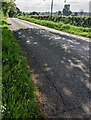
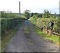
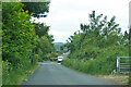
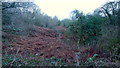
11 photos from this area
Area Information
Key information about the NP25 4SB including its size, population, and administrative classification.
- Area Type
- Postcode
- Area Size
- 4.5 hectares
- Population
- 1289
- Population Density
- 71 people/km²
House Prices in NP25 4SB
10
Properties
£499,133
Average Sold Price
£261,300
Lowest Price
£750,000
Highest Price
Showing 10 properties
| Address | Type | Beds | Baths | Last Sale Price | Last Sale Date | |
|---|---|---|---|---|---|---|
| March Meadow, Green Pastures, Penallt, NP25 4SB | Detached | 3 | 3 | £648,500 | Sep 2024 | |
| Combe Bank, Green Pastures, Penallt, NP25 4SB | Detached | 5 | 2 | £750,000 | Sep 2022 | |
| Holly Tree House, Green Pastures, Penallt, NP25 4SB | Detached | 5 | 2 | £540,000 | Sep 2020 | |
| Groes Vane House, Green Pastures, Penallt, NP25 4SB | Detached | - | - | £499,999 | Sep 2009 | |
| Beckys Bungalow, Green Pastures, Penallt, NP25 4SB | Bungalow | 2 | 2 | £261,300 | Apr 2004 | |
| Stone Barn House, 1 Green Pastures, Penallt, NP25 4SB | Detached | - | - | £295,000 | Apr 2000 | |
| Natterjack, Green Pastures, Penallt, NP25 4SB | Detached | - | - | - | - | |
| Iverbridge, Green Pastures, Penallt, NP25 4SB | Detached | - | - | - | - | |
| Tyr Onen, 6 Green Pastures, Penallt, NP25 4SB | Detached | - | - | - | - | |
| Tyr Wennol, Green Pastures, Penallt, NP25 4SB | Detached | - | - | - | - |
Energy Efficiency in NP25 4SB
Amenities
Schools
| Rank | School | Type | Entry gender | Ages |
|---|
Explore more schools in this area
Go to Schools tabDemographics
Household Size
Two person
most common
Accommodation Type
Houses
most common
Tenure
93
majority
Ethnic Group
White
most common
Religion
N/A
most common
Household Composition
N/A
most common
Age
47
median
Adults (30-64 years)
most common
Household Deprivation
N/A
with no deprivation
NS-SEC
55
in Lower managerial occupations
Explore more demographic insights in this area
Go to Demographics tabPlanning
Planning Constraints
- Flood RiskPremium
- Ramsar Wetland SitesPremium
- Protected Nature ReservePremium
- Protected WoodlandPremium
- Crime RiskPremium