Area Overview for CF48 4ET
Photos of CF48 4ET
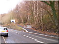
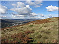
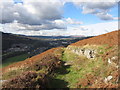
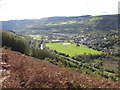


26 photos from this area
Area Information
Key information about the CF48 4ET including its size, population, and administrative classification.
- Area Type
- Postcode
- Area Size
- 12.7 hectares
- Population
- 1475
- Population Density
- 82 people/km²
House Prices in CF48 4ET
40
Properties
£63,813
Average Sold Price
£16,000
Lowest Price
£126,000
Highest Price
Showing 40 properties
| Address | Type | Beds | Baths | Last Sale Price | Last Sale Date | |
|---|---|---|---|---|---|---|
| 22 Park Place, Troedyrhiw, Merthyr Tydfil, CF48 4ET | Terraced | 3 | 1 | £83,500 | Jul 2025 | |
| 29 Park Place, Troedyrhiw, Merthyr Tydfil, CF48 4ET | house | - | - | £126,000 | Sep 2021 | |
| 36 Park Place, Troedyrhiw, Merthyr Tydfil, CF48 4ET | house | - | - | £83,000 | Jul 2021 | |
| 8 Park Place, Troedyrhiw, Merthyr Tydfil, CF48 4ET | Terraced | 2 | 1 | £67,950 | Mar 2020 | |
| 35 Park Place, Troedyrhiw, Merthyr Tydfil, CF48 4ET | house | - | - | £75,000 | Sep 2019 | |
| 24 Park Place, Troedyrhiw, Merthyr Tydfil, CF48 4ET | Terraced | 3 | 1 | £114,000 | Jul 2019 | |
| 27 Park Place, Troedyrhiw, Merthyr Tydfil, CF48 4ET | Terraced | 2 | 1 | £81,000 | Jun 2019 | |
| 5 Park Place, Troedyrhiw, Merthyr Tydfil, CF48 4ET | house | - | - | £94,000 | May 2019 | |
| 6 Park Place, Troedyrhiw, Merthyr Tydfil, CF48 4ET | Terraced | 3 | 1 | £72,500 | Feb 2018 | |
| 3 Park Place, Troedyrhiw, Merthyr Tydfil, CF48 4ET | Terraced | 3 | 1 | £57,500 | Jun 2017 |
Page 1 of 4
Energy Efficiency in CF48 4ET
Amenities
Schools
| Rank | School | Type | Entry gender | Ages |
|---|
Explore more schools in this area
Go to Schools tabDemographics
Household Size
One person
most common
Accommodation Type
Houses
most common
Tenure
57
majority
Ethnic Group
White
most common
Religion
N/A
most common
Household Composition
N/A
most common
Age
47
median
Adults (30-64 years)
most common
Household Deprivation
N/A
with no deprivation
NS-SEC
20
in Lower managerial occupations
Explore more demographic insights in this area
Go to Demographics tabPlanning
Planning Constraints
- Flood RiskPremium
- Ramsar Wetland SitesPremium
- Area of Outstanding Natural BeautyPremium
- Protected Nature ReservePremium
- Protected WoodlandPremium
- Crime RiskPremium