Area Overview for LL41 3DB
Photos of LL41 3DB
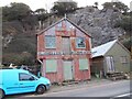
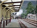
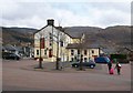
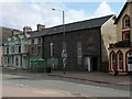
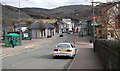
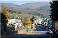
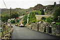
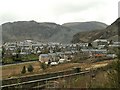
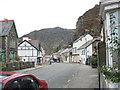
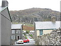
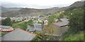
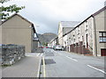
100 photos from this area
Area Information
Key information about the LL41 3DB including its size, population, and administrative classification.
- Area Type
- Postcode
- Area Size
- 2517 m²
- Population
- 1031
- Population Density
- 395 people/km²
House Prices in LL41 3DB
15
Properties
£83,750
Average Sold Price
£83,750
Lowest Price
£83,750
Highest Price
Showing 15 properties
| Address | Type | Beds | Baths | Last Sale Price | Last Sale Date | |
|---|---|---|---|---|---|---|
| The Old Coach House, Heol Meddyg, Blaenau Ffestiniog, LL41 3DB | Semi-detached | 2 | 1 | £83,750 | Jul 2025 | |
| The Old Surgery, Heol Meddyg, Blaenau Ffestiniog, LL41 3DB | Terraced | 3 | 1 | - | - | |
| Alwena Jones & Jones, Bowydd Building, 9 High Street, Blaenau Ffestiniog, LL41 3DB | Maisonette | - | - | - | - | |
| Halifax Plc, High Street, Blaenau Ffestiniog, LL41 3DB | Retail | - | - | - | - | |
| Store, Heol Meddyg, Blaenau Ffestiniog, LL41 3DB | warehouse | - | - | - | - | |
| Flat, Blaenau Kebab, 10 High Street, Blaenau Ffestiniog, LL41 3DB | Flat | - | - | - | - | |
| Basement Flat, 11 High Street, Blaenau Ffestiniog, LL41 3DB | Maisonette | - | - | - | - | |
| 11 High Street, Blaenau Ffestiniog, LL41 3DB | Terraced | - | - | - | - | |
| Flat 6, Llys Meddyg, 12 High Street, Blaenau Ffestiniog, LL41 3DB | Flat | - | - | - | - | |
| 16 High Street, Blaenau Ffestiniog, LL41 3DB | Terraced | - | - | - | - |
Page 1 of 2
Energy Efficiency in LL41 3DB
Amenities
Schools
| Rank | School | Type | Entry gender | Ages |
|---|
Explore more schools in this area
Go to Schools tabDemographics
Household Size
One person
most common
Accommodation Type
Houses
most common
Tenure
63
majority
Ethnic Group
White
most common
Religion
N/A
most common
Household Composition
N/A
most common
Age
47
median
Adults (30-64 years)
most common
Household Deprivation
N/A
with no deprivation
NS-SEC
19
in Lower managerial occupations
Explore more demographic insights in this area
Go to Demographics tabPlanning
Planning Constraints
- Flood RiskPremium
- Ramsar Wetland SitesPremium
- Area of Outstanding Natural BeautyPremium
- Protected Nature ReservePremium
- Protected WoodlandPremium
- Crime RiskPremium