Area Overview for Sealand Community
Photos of Sealand Community
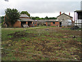
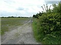
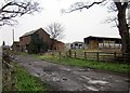
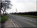
Area Information
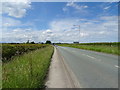
Sealand Community sits as a civil parish within Flintshire on the edge of the Wirral peninsula. This location places the area within the Deeside conurbation, near the Wales-England border. You will find the community approximately four miles west of Chester and fifteen miles north of Wrexham. The parish covers an area size of 20.4 square kilometres and holds a population of around 1,826 residents. The local landscape has deep historical roots, tracing back to glacial ice from the Irish Sea that eroded the River Dee estuary. Historical records indicate a channel once linked the Mersey through this location. The modern estate evolved after a Welsh Land Settlement established original settlers like Dan Jones in the region. Daily life here involves proximity to significant historical structures. RAF Sealand operated from 1916 before passing to US control until 1957, after which it became a Ministry of Defence facility. The Sealand Community Council originated as a parish council under the Local Government Act 1894. This history continues to shape the administrative identity of the area today. Residents live in a setting defined by its geological origins and its transition from military use to a residential parish. The mix of modern infrastructure and ancient estuary sands creates a distinct environment for living. You gain access to a community that balances rural roots with its position on the Deeside industrial corridor.
- Area Type
- Parish
- Area Size
- 20.4 km²
- Population
- Not available
- Population Density
- Not available
Demographics
The population profile of Sealand Community reveals a significantly older demographic compared to the national average. The median age stands at 70 years. This figure indicates that the community is dominated by older residents, likely those approaching or past retirement age. Most common age data reflects this skew towards the "Age: Total" category without specific sub-range breakdowns in the current dataset. Home ownership levels stand at 53 per cent. This figure suggests that slightly more than half of the households own their homes outright or with a mortgage. The remaining majority live in rented accommodation or other tenure types. Household composition and accommodation type data are recorded as total figures without specific breakdowns for different group types. Consequently, you cannot determine the exact split between single-occupancy households, families with children, or multi-generation homes from the available statistics. Ethnic group and religious affiliation data are similarly recorded as total entries, meaning no specific predominant groups or faiths are highlighted in the current dataset. Despite these statistical gaps, the high median age suggests a quieter, slower-paced neighbourhood. This profile typically indicates fewer families with young children compared to urban areas. You are entering a community where the primary residents are senior citizens enjoying retirement in a Welsh community with deep historical ties.
Household Size
Accommodation Type
Tenure
Ethnic Group
Religion
Household Composition
Age
Household Deprivation
NS-SEC
Explore more demographic insights in this area
Go to Demographics tabPlanning
Planning Constraints
- Flood RiskPremium
- Ramsar Wetland SitesPremium
- Area of Outstanding Natural BeautyPremium
- Protected Nature ReservePremium
- Protected WoodlandPremium
- Crime RiskPremium