Area Overview for Saltney Community
Photos of Saltney Community


Area Information
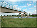
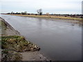
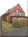
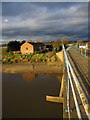
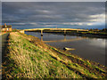
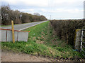
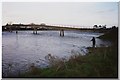
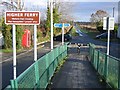
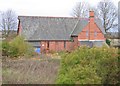
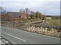
Saltney Community sits straddling the England–Wales border within a civil parish covering just 3.7 km². This unique location places the town directly on the boundary between Flintshire in Wales and Cheshire in England, with Boundary Lane marking the only urban street where this border runs down the middle. You will find the local government community lies entirely in Wales under the CH4 postcode, yet the area feels contiguous with Chester's built-up zone. The site is approximately five miles from Deeside, offering a blend of suburban residential living alongside immediate access to commercial amenities. Your daily life includes walking past places like St David's Retail Park and historic sites linked to the former salt marshes by the River Dee. The area has developed significantly since the late 19th century, growing through industrial phases involving shipbuilding and engineering works such as those established by Henry Wood & Company in 1847. Today, the community centre serves active groups like Saltney Town FC, which was formed in 2010. You can live here in close proximity to local shops, pubs such as the City Arms, and primary schools while remaining part of a historic landscape that dates back to Sir John Glynne's Canal. Freedom is a defining characteristic of living in Saltney Community, where you enjoy solid infrastructure without the constraints of major planning restrictions like AONB status or Ramsar sites.
- Area Type
- Parish
- Area Size
- 3.7 km²
- Population
- Not available
- Population Density
- Not available
Demographics
The community in Saltney Community displays a distinct age profile with a median age of 70. This statistic indicates a population skewed significantly towards older residents compared to many other UK neighbourhoods. The most common age grouping reflects this overall demographic trend, suggesting a retirement-oriented or mature village atmosphere rather than a family-heavy demographic. You should expect a high level of home ownership, with 60% of dwellings owned outright or with a mortgage. This figure positions Saltney Community as primarily an owner-occupied area rather than a rental market dominated by tenants. The data does not specify the breakdown of household composition beyond the total category, meaning you do not have precise figures on single-person households versus families with children. Similarly, specific details on predominant ethnic groups, religious affiliations, and the total breakdown of accommodation types are not included in the available records. The absence of a larger youth population alongside the high median age suggests social life may centre around community facilities like the church halls and sports clubs. When considering the quality of life, the high ownership rate provides stability for residents who wish to settle permanently in this border town without the uncertainty of tenancy agreements. The mature demographic also likely influences local services, with demand focused on healthcare and leisure rather than childcare.
Household Size
Accommodation Type
Tenure
Ethnic Group
Religion
Household Composition
Age
Household Deprivation
NS-SEC
Explore more demographic insights in this area
Go to Demographics tabPlanning
Planning Constraints
- Flood RiskPremium
- Ramsar Wetland SitesPremium
- Area of Outstanding Natural BeautyPremium
- Protected Nature ReservePremium
- Protected WoodlandPremium
- Crime RiskPremium