Area Overview for Queensferry Community
Photos of Queensferry Community
Area Information
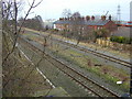
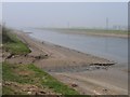
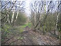
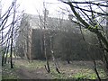
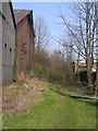
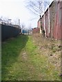
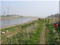
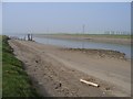
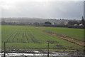
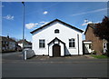
Living in Queensferry Community means residing within a civil parish that defines a distinct corner of Flintshire, Wales. This settlement sits 4.3 km² along the River Dee, positioning it near the English border and between the market towns of Connah's Quay, Shotton and Saltney Ferry. You are situated within the wider Deeside conurbation, an industrial and residential zone named after the river itself. The area carries a historical weight, having transitioned from its origins as Lower Ferry to receive new names during the 19th century to mark royal coronations. The Jubilee Bridge, also known as the Blue Bridge, currently spans the River Dee as a double leaf rolling bascule bridge, linking the community to the neighbouring Garden City. While the railway station on the North Wales Coast Line closed in 1966, the road network remains active via the A494 dual carriageway and local routes like the B5441 and B5129. Daily life revolves around practical amenities, including the Deeside Leisure Centre, which hosts both sports activities and music concerts. A prominent local landmark is the Memorial Institute, a corrugated black and white building situated near the Asda entrance on the coast road. This blend of industrial heritage and immediate amenity access characterises the experience of making Queensferry Community your home.
- Area Type
- Parish
- Area Size
- 4.3 km²
- Population
- Not available
- Population Density
- Not available
Demographics
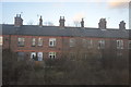
The population profile of Queensferry Community presents a distinctly older demographic environment. Data indicates that the median age in the parish is 70 years, suggesting a community comprised largely of retirees and older adults. The most common age category listed is simply labelled as "Age: Total," which implies a general spread of residents across the spectrum but heavily weighted towards the senior end of the scale. With a home ownership rate of 60%, a significant portion of local residents have already secured their properties through purchase. This high level of ownership often correlates with the older age profile, as younger families typically rent or seek purchase in areas with different economic dynamics. The parish includes the village of Sandycroft, adding a rural texture to the town character. Unlike many fast-growing urban zones, you will find a quieter atmosphere shaped by this age distribution. The presence of over six homes in every ten likely being owner-occupied means you can expect established neighbourhoods where residents have put down deep roots. This demographic structure creates a stable, settled environment distinct from the high-turnover zones often found near major industrial hubs.
Household Size
Accommodation Type
Tenure
Ethnic Group
Religion
Household Composition
Age
Household Deprivation
NS-SEC
Explore more demographic insights in this area
Go to Demographics tabPlanning
Planning Constraints
- Flood RiskPremium
- Ramsar Wetland SitesPremium
- Area of Outstanding Natural BeautyPremium
- Protected Nature ReservePremium
- Protected WoodlandPremium
- Crime RiskPremium