Area Overview for Llanasa Community
Photos of Llanasa Community
Area Information
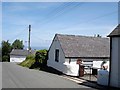
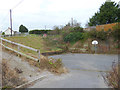
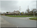
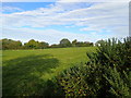
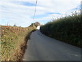
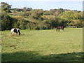
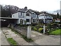
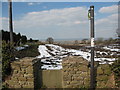
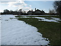
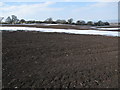
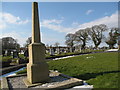
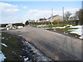
Living in Llanasa Community offers a distinctive experience centred on a civil parish that spans 31.9 km² within Flintshire in north-east Wales. You will find yourself in an ancient parish originally comprising townships such as Gronant, Picton, and Golden Grove, all defined by a deep historical connection to the local church dedicated to St Asaph and St Kentigern. The area possesses a quiet character rooted in its long history, with the current 15th-century church replacing an earlier structure mentioned in the Domesday Book of 1087. Notable landmarks include the Grade I listed parish church, which houses 14th-century tomb slabs and serves as a memorial site for the 1857 drowning of a Point of Ayr lifeboat crew. Your daily life here revolves around these significant heritage sites, including Henblas, a Grade I listed Renaissance mansion built in 1645 by the Morgan family. The landscape also features a 1762 sundial, a 1725 lychgate, and St Asaph Cathedral relocated relics by 1281. You move through an area where the church hall and local archives hold records from centuries past, offering a sense of continuity for residents. The parish centre sits at coordinates 53.334795, -3.319971, anchoring a community where the past remains visibly present. Homes here are surrounded by a setting that has protected status as an Area of Outstanding Natural Beauty and contains Ramsar wetland sites. When you consider Llanasa Community, you are choosing a location defined by specific historical monuments and a defined geographical boundary rather than rapid modernisation.
- Area Type
- Parish
- Area Size
- 31.9 km²
- Population
- Not available
- Population Density
- Not available
Demographics
The community profile of Llanasa reflects a settled environment where residents have long called this parish home. The median age stands at 70 years, indicating a population weighted heavily towards older adults. This age distribution suggests a neighbourhood where retirees and older generations form the core demographic, a reality that shapes local facilities and social interactions. You will find that 72% of homes are owner-occupied, a high figure that points to stability within the parish rather than a transient rental market. This strong level of homeownership reinforces the idea that you are likely buying into an established household environment where people have roots in the area. Household composition data reflects a total population structure supportive of long-term residence. While specific breakdowns by household type are recorded, the overarching statistic of total household composition aligns with the high home ownership rate. Accommodation types in the parish are naturally suited to this demographic, with a total inventory that supports the needs of older residents. You do not encounter significant data gaps regarding the ethnic or religious makeup; however, the primary demographic driver remains age. Living in Llanasa means entering a village where the average resident is significantly older than the national average for Wales or England. This is a quiet community where the social fabric is built around longevity and established family lines rather than new migration or high turnover.
Household Size
Accommodation Type
Tenure
Ethnic Group
Religion
Household Composition
Age
Household Deprivation
NS-SEC
Explore more demographic insights in this area
Go to Demographics tabPlanning
Planning Constraints
- Flood RiskPremium
- Ramsar Wetland SitesPremium
- Area of Outstanding Natural BeautyPremium
- Protected Nature ReservePremium
- Protected WoodlandPremium
- Crime RiskPremium