Area Overview for LL19 9TH
Photos of LL19 9TH
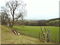
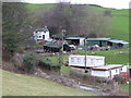
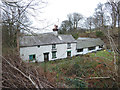
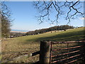
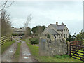
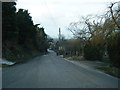
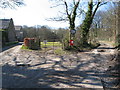
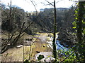
13 photos from this area
Area Information
Key information about the LL19 9TH including its size, population, and administrative classification.
- Area Type
- Postcode
- Area Size
- 2.0 hectares
- Population
- 1479
- Population Density
- 282 people/km²
House Prices in LL19 9TH
19
Properties
£186,223
Average Sold Price
£41,000
Lowest Price
£393,000
Highest Price
Showing 19 properties
| Address | Type | Beds | Baths | Last Sale Price | Last Sale Date | |
|---|---|---|---|---|---|---|
| Robin Hill, Llanasa Road, Gronant, LL19 9TH | Detached | 5 | 2 | £393,000 | Jun 2024 | |
| Parkfield, Llanasa Road, Gronant, LL19 9TH | Bungalow | - | - | £140,000 | Sep 2022 | |
| Manora, Llanasa Road, Gronant, LL19 9TH | Bungalow | 2 | 2 | £191,000 | Jul 2022 | |
| Le Bateau, Llanasa Road, Gronant, LL19 9TH | Bungalow | 3 | 1 | £275,000 | Jan 2022 | |
| Woodlands, Llanasa Road, Gronant, LL19 9TH | Terraced | 2 | 1 | £170,000 | Oct 2019 | |
| Derwen Cottage, Llanasa Road, Gronant, LL19 9TH | Bungalow | 3 | 1 | £240,000 | Oct 2018 | |
| Monfa, Llanasa Road, Gronant, LL19 9TH | Bungalow | 3 | 2 | £182,500 | Jul 2018 | |
| Glasfor, Llanasa Road, Gronant, LL19 9TH | Bungalow | 4 | - | £233,000 | Aug 2011 | |
| Sea View, Llanasa Road, Gronant, LL19 9TH | Semi-detached | - | - | £130,000 | Aug 2008 | |
| Kingscot, Llanasa Road, Gronant, LL19 9TH | Terraced | 2 | 1 | £41,000 | Mar 2003 |
Page 1 of 2
Energy Efficiency in LL19 9TH
Amenities
Schools
| Rank | School | Type | Entry gender | Ages |
|---|
Explore more schools in this area
Go to Schools tabDemographics
Household Size
Two person
most common
Accommodation Type
Houses
most common
Tenure
71
majority
Ethnic Group
White
most common
Religion
N/A
most common
Household Composition
N/A
most common
Age
47
median
Adults (30-64 years)
most common
Household Deprivation
N/A
with no deprivation
NS-SEC
25
in Lower managerial occupations
Explore more demographic insights in this area
Go to Demographics tabPlanning
Planning Constraints
- Flood RiskPremium
- Ramsar Wetland SitesPremium
- Area of Outstanding Natural BeautyPremium
- Protected Nature ReservePremium
- Protected WoodlandPremium
- Crime RiskPremium