Area Overview for LL11 5HN
Photos of LL11 5HN
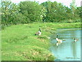
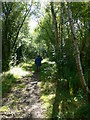
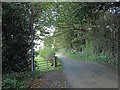

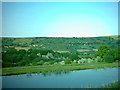
6 photos from this area
Area Information
Key information about the LL11 5HN including its size, population, and administrative classification.
- Area Type
- Postcode
- Area Size
- 24.7 hectares
- Population
- 1687
- Population Density
- 115 people/km²
House Prices in LL11 5HN
12
Properties
£247,233
Average Sold Price
£73,500
Lowest Price
£440,000
Highest Price
Showing 12 properties
| Address | Type | Beds | Baths | Last Sale Price | Last Sale Date | |
|---|---|---|---|---|---|---|
| Archway House, Mynydd Bychan Junction To Ffordd Llanfynydd Junction, Llanfynydd, LL11 5HN | Detached | 4 | 3 | £440,000 | Mar 2025 | |
| Ivy House, Ffordd Llanfynydd, Llanfynydd, LL11 5HN | Terraced | 2 | 1 | £195,000 | Jun 2021 | |
| Ty Capel Penuel, Ffordd Llanfynydd, Llanfynydd, LL11 5HN | Terraced | - | - | £210,000 | Apr 2008 | |
| 2, Penuel Cottage, Ffordd Llanfynydd, Llanfynydd, LL11 5HN | Cottage | 2 | 1 | £124,900 | Jan 2007 | |
| Crossing Cottage, Ffordd Llanfynydd, Llanfynydd, LL11 5HN | house | - | - | £440,000 | Nov 2006 | |
| Llys Awel, Ffordd Llanfynydd Junction To Tithe Barn Junction, Llanfynydd, LL11 5HN | Detached | - | - | £73,500 | Sep 1998 | |
| Laurel House, Ffordd Llanfynydd, Llanfynydd, LL11 5HN | Terraced | 3 | 1 | - | - | |
| Pant Y Stain, Ffordd Llanfynydd, Llanfynydd, LL11 5HN | Detached | 4 | 2 | - | - | |
| Y Bwthyn Stabl, Ffordd Llanfynydd, Llanfynydd, LL11 5HN | house | - | - | - | - | |
| 1, Penuel Cottage, Ffordd Llanfynydd, Llanfynydd, LL11 5HN | house | 2 | - | - | - |
Page 1 of 2
Energy Efficiency in LL11 5HN
Amenities
Schools
| Rank | School | Type | Entry gender | Ages |
|---|
Explore more schools in this area
Go to Schools tabDemographics
Household Size
Two person
most common
Accommodation Type
Houses
most common
Tenure
76
majority
Ethnic Group
White
most common
Religion
N/A
most common
Household Composition
N/A
most common
Age
47
median
Adults (30-64 years)
most common
Household Deprivation
N/A
with no deprivation
NS-SEC
35
in Lower managerial occupations
Explore more demographic insights in this area
Go to Demographics tabPlanning
Planning Constraints
- Flood RiskPremium
- Ramsar Wetland SitesPremium
- Area of Outstanding Natural BeautyPremium
- Protected Nature ReservePremium
- Protected WoodlandPremium
- Crime RiskPremium