Area Overview for Leeswood and Pontblyddyn Community
Photos of Leeswood and Pontblyddyn Community

Area Information
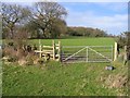
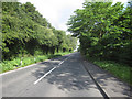
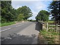
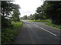
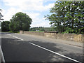
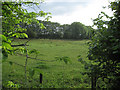
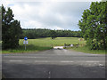
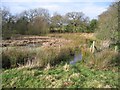
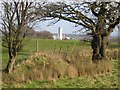
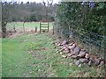
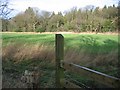
Leeswood and Pontblyddyn Community is a civil parish in Flintshire, Wales, covering an area of 11.7 km². You will find this location approximately two miles southeast of Mold, home to roughly 2,123 people across the villages of Leeswood and Pontblyddyn. Living in Leeswood and Pontblyddyn Community means engaging with a landscape shaped by centuries of industry, from the coal and iron mines of the past to remnants of a 19th-century cannel coal oil boom. The parish is distinctive for its historic landmarks, including Plas Teg, Leeswood Hall, and the famous White Gates crafted by the Davies brothers. Christ Church in Pontblyddyn stands as a testament to the village's growth during that industrial era. Today, the area attracts commuters seeking affordable housing, yet it retains a quiet, rural character defined by Bronze Age cairns and wooded areas. The history here is deep, with Leeswood first mentioned in the Domesday Book and the land passing through the hands of the Stanley family by the 15th century. Location-wise, the parish offers proximity to Mold while maintaining a village feel. Whether you are drawn by the local community history or the practicality of its location near Cheshire, Leeswood and Pontblyddyn Community provides a specific Welsh lifestyle grounded in local heritage. Homes here sit within an environment that balances historical significance with modern residential needs.
- Area Type
- Parish
- Area Size
- 11.7 km²
- Population
- Not available
- Population Density
- Not available
Demographics
The community profile in Leeswood and Pontblyddyn Community reflects a settled, older population. The median age is 70 years, indicating a demographic that skews significantly towards retirement ages. This age profile often correlates with higher stability and established neighbourhoods. Home ownership stands at a solid 67%, meaning more than two out of every three residents own their property outright or with a mortgage. Household composition data classifies the area as having a total household makeup without specific breakdowns for families versus singles in the provided figures. Accommodation types also fall under a total classification, though the high ownership rate suggests a significant stock of owner-occupied homes rather than private rentals. Ethnic and religious demographics are listed as total categories in the available information, implying a generally homogenous community typical of rural Welsh parishes. The low median age explains why the area acts as a desirable destination for those approaching or in retirement. Living in Leeswood and Pontblyddyn Community involves joining a group of residents who have likely lived in the area for decades. This demographic stability fosters long-term friendships and a slow pace of life. For anyone considering buying homes in Leeswood and Pontblyddyn Community, the high ownership rate suggests a stable market where properties are often passed down or held over long periods. You are buying into an environment of permanence.
Household Size
Accommodation Type
Tenure
Ethnic Group
Religion
Household Composition
Age
Household Deprivation
NS-SEC
Explore more demographic insights in this area
Go to Demographics tabPlanning
Planning Constraints
- Flood RiskPremium
- Ramsar Wetland SitesPremium
- Area of Outstanding Natural BeautyPremium
- Protected Nature ReservePremium
- Protected WoodlandPremium
- Crime RiskPremium