Area Overview for CH8 9UT
Photos of CH8 9UT
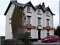
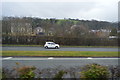
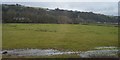
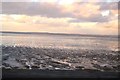

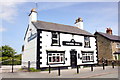
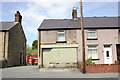
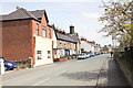
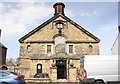
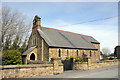
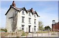
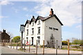
44 photos from this area
Area Information
Key information about the CH8 9UT including its size, population, and administrative classification.
- Area Type
- Postcode
- Area Size
- 3.2 hectares
- Population
- 1883
- Population Density
- 203 people/km²
House Prices in CH8 9UT
11
Properties
£150,000
Average Sold Price
£51,000
Lowest Price
£287,500
Highest Price
Showing 11 properties
| Address | Type | Beds | Baths | Last Sale Price | Last Sale Date | |
|---|---|---|---|---|---|---|
| Bron Coed, Well Lane, Ffynnongroyw, CH8 9UT | house | 2 | 1 | £225,000 | Aug 2024 | |
| Ffestiniog Villa, Well Lane, Ffynnongroyw, CH8 9UT | Semi-detached | 2 | - | £165,000 | Apr 2023 | |
| Maes Y Coed, Well Lane, Ffynnongroyw, CH8 9UT | Semi-detached | 2 | 1 | £220,000 | Apr 2022 | |
| Fron Deg, Well Lane, Ffynnongroyw, CH8 9UT | house | 2 | 2 | £110,000 | May 2021 | |
| Hyfrydle, Well Lane, Ffynnongroyw, CH8 9UT | house | 4 | 1 | £287,500 | Sep 2019 | |
| Ochr Y Coed, Well Lane, Ffynnongroyw, CH8 9UT | Bungalow | - | - | £97,500 | Aug 2012 | |
| Derlwyn, Well Lane, Ffynnongroyw, CH8 9UT | Detached | 2 | 1 | £117,000 | Nov 2006 | |
| Gwynfa, Well Lane, Ffynnongroyw, CH8 9UT | house | - | - | £77,000 | May 2004 | |
| Twmpath, Well Lane, Ffynnongroyw, CH8 9UT | Bungalow | - | - | £51,000 | May 2003 | |
| The Old Bakery, Well Lane, Ffynnongroyw, CH8 9UT | Bungalow | - | - | - | - |
Page 1 of 2
Energy Efficiency in CH8 9UT
Amenities
Schools
| Rank | School | Type | Entry gender | Ages |
|---|
Explore more schools in this area
Go to Schools tabDemographics
Household Size
Two person
most common
Accommodation Type
Houses
most common
Tenure
71
majority
Ethnic Group
White
most common
Religion
N/A
most common
Household Composition
N/A
most common
Age
47
median
Adults (30-64 years)
most common
Household Deprivation
N/A
with no deprivation
NS-SEC
23
in Lower managerial occupations
Explore more demographic insights in this area
Go to Demographics tabPlanning
Planning Constraints
- Flood RiskPremium
- Ramsar Wetland SitesPremium
- Area of Outstanding Natural BeautyPremium
- Protected Nature ReservePremium
- Protected WoodlandPremium
- Crime RiskPremium