Area Overview for CH8 9QU
Photos of CH8 9QU
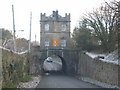
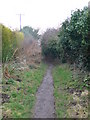
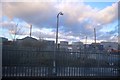
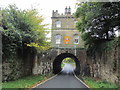
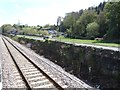
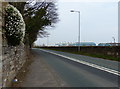
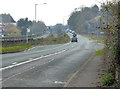
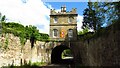
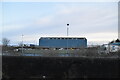
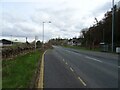
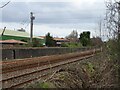
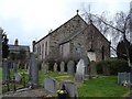
34 photos from this area
Area Information
Key information about the CH8 9QU including its size, population, and administrative classification.
- Area Type
- Postcode
- Area Size
- 8.3 hectares
- Population
- 1891
- Population Density
- 160 people/km²
House Prices in CH8 9QU
23
Properties
£159,643
Average Sold Price
£90,000
Lowest Price
£277,000
Highest Price
Showing 23 properties
| Address | Type | Beds | Baths | Last Sale Price | Last Sale Date | |
|---|---|---|---|---|---|---|
| Hedgerow, Bridleway 104, Mostyn, CH8 9QU | house | 3 | 1 | £245,000 | May 2021 | |
| Tan Y Dderwen, Bridleway 104, Mostyn, CH8 9QU | Detached | 4 | 2 | £277,000 | Jul 2019 | |
| Casita Bella, Bridleway 104, Mostyn, CH8 9QU | Bungalow | - | - | £152,500 | Apr 2017 | |
| Cartref, Bridleway 104, Mostyn, CH8 9QU | house | - | - | £90,000 | Jun 2011 | |
| Glasfryn, Bridleway 104, Mostyn, CH8 9QU | house | - | - | £143,000 | Oct 2007 | |
| Aventine, Bridleway 104, Mostyn, CH8 9QU | Bungalow | - | - | £120,000 | Nov 2002 | |
| Helygen, Bridleway 104, Mostyn, CH8 9QU | Bungalow | - | - | £90,000 | Jan 2002 | |
| Sammat, Bridleway 104, Mostyn, CH8 9QU | Bungalow | 3 | 1 | - | - | |
| Bryn Eithin, Bridleway 104, Mostyn, CH8 9QU | Bungalow | 3 | 1 | - | - | |
| Ty Newydd, Bridleway 104, Mostyn, CH8 9QU | Detached | 5 | 2 | - | - |
Page 1 of 3
Energy Efficiency in CH8 9QU
Amenities
Schools
| Rank | School | Type | Entry gender | Ages |
|---|
Explore more schools in this area
Go to Schools tabDemographics
Household Size
Two person
most common
Accommodation Type
Houses
most common
Tenure
58
majority
Ethnic Group
White
most common
Religion
N/A
most common
Household Composition
N/A
most common
Age
47
median
Adults (30-64 years)
most common
Household Deprivation
N/A
with no deprivation
NS-SEC
21
in Lower managerial occupations
Explore more demographic insights in this area
Go to Demographics tabPlanning
Planning Constraints
- Flood RiskPremium
- Ramsar Wetland SitesPremium
- Area of Outstanding Natural BeautyPremium
- Protected Nature ReservePremium
- Protected WoodlandPremium
- Crime RiskPremium