Area Overview for CH8 9LF
Photos of CH8 9LF
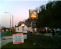
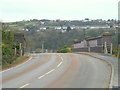
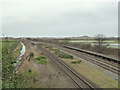
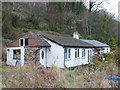
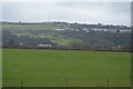
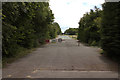
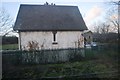
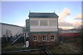
38 photos from this area
Area Information
Key information about the CH8 9LF including its size, population, and administrative classification.
- Area Type
- Postcode
- Area Size
- 6.3 hectares
- Population
- 1479
- Population Density
- 282 people/km²
House Prices in CH8 9LF
7
Properties
£211,800
Average Sold Price
£89,000
Lowest Price
£335,000
Highest Price
Showing 7 properties
| Address | Type | Beds | Baths | Last Sale Price | Last Sale Date | |
|---|---|---|---|---|---|---|
| Cartref, Berllan Lane, Gwespyr, CH8 9LF | Detached | 3 | 1 | £335,000 | Nov 2022 | |
| Noddfa Cottage, Berllan Lane, Gwespyr, CH8 9LF | Detached | 3 | 1 | £232,000 | Oct 2020 | |
| Hafryn, Berllan Lane, Gwespyr, CH8 9LF | Detached | 2 | 1 | £238,000 | Nov 2018 | |
| Talfryn, Berllan Lane, Gwespyr, CH8 9LF | Bungalow | - | - | £165,000 | Sep 2010 | |
| Penrhiw, Berllan Lane, Gwespyr, CH8 9LF | Detached | - | - | £89,000 | Jul 1998 | |
| Pentre Isa, Berllan Lane, Gwespyr, CH8 9LF | Detached | - | - | - | - | |
| Berllan Farm, Berllan Lane, Gwespyr, CH8 9LF | house | - | - | - | - |
Energy Efficiency in CH8 9LF
Amenities
Schools
| Rank | School | Type | Entry gender | Ages |
|---|
Explore more schools in this area
Go to Schools tabDemographics
Household Size
Two person
most common
Accommodation Type
Houses
most common
Tenure
71
majority
Ethnic Group
White
most common
Religion
N/A
most common
Household Composition
N/A
most common
Age
47
median
Adults (30-64 years)
most common
Household Deprivation
N/A
with no deprivation
NS-SEC
25
in Lower managerial occupations
Explore more demographic insights in this area
Go to Demographics tabPlanning
Planning Constraints
- Flood RiskPremium
- Ramsar Wetland SitesPremium
- Area of Outstanding Natural BeautyPremium
- Protected Nature ReservePremium
- Protected WoodlandPremium
- Crime RiskPremium