Area Overview for CH8 9AG
Photos of CH8 9AG
Area Information
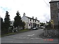
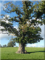
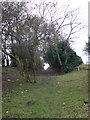
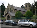
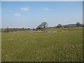
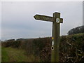
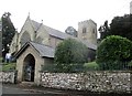
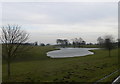
Living in CH8 9AG means settling within a small residential cluster covering just 2.2 hectares in Wales. You are part of a community of 2,243 people, where daily life unfolds at a slower pace compared to major urban centres. This postcode sits within the historic parish of Whitford, an area encompassing nearly 8,000 acres including the villages of Carmel, Gorsedd, Lloc, Pantasaph and Whitford itself. The location benefits from a gradual rise from the estuary of the Dee, offering a setting that blends rural tranquility with proximity to the coast. Residents enjoy a strong sense of place rooted in the region's history, from the Domesday Book entry of 1086 to the community purchase of Glebe Field in 1976 to preserve greenspace. The area is defined by its low population density of 105 people per square kilometre, ensuring that homes in CH8 9AG are not cluttered by urban sprawl. Instead, you find a neighbourhood where the character remains intact, supported by ancient features like Whitford Dyke earth bank and remnants of Bronze Age settlements nearby. For those seeking a quiet introduction to village life without being isolated, this postcode offers a distinct alternative to the faster pace of Holywell, located just three miles away.
- Area Type
- Postcode
- Area Size
- 2.2 hectares
- Population
- 2243
- Population Density
- 105 people/km²
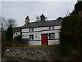
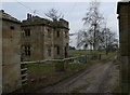
The housing market in CH8 9AG is overwhelmingly owner-occupied, with 88% of properties held by their current owners. This high ownership rate stands in stark contrast to rental-heavy urban districts and signals a market where homes in CH8 9AG are primarily viewed as long-term investments and family bases rather than temporary lodging. Houses make up the vast majority of the stock, meaning you will not find blocks of flats or high-rise apartments as common features here. The demand in this area typically comes from buyers seeking rural connectivity without excessive distance from services. Because the area covers only 2.2 hectares, inventory is naturally limited, yet the strong ownership rate suggests steady turnover driven by internal mobility or reunion with family networks rather than speculative buying. Prospective buyers looking to enter the market here should expect to compete with other permanent residents who value stability. The accommodation style remains consistent with the village character, avoiding the variety of property typologies found in larger towns.
House Prices in CH8 9AG
Showing 4 properties
| Address | Type | Beds | Baths | Last Sale Price | Last Sale Date | |
|---|---|---|---|---|---|---|
| Lychgate House, 1 St Marys Court, Whitford, CH8 9AG | house | 4 | 3 | £630,000 | Mar 2025 | |
| 3 St Marys Court, Whitford, CH8 9AG | Detached | 5 | 3 | £405,000 | Dec 2014 | |
| 2 St Marys Court, Whitford, CH8 9AG | house | 5 | - | £405,000 | Mar 2010 | |
| 4 St Marys Court, Whitford, CH8 9AG | house | - | - | £425,000 | Oct 2009 |
Energy Efficiency in CH8 9AG
Daily conveniences for residents of CH8 9AG extend just a short drive into the surrounding towns, bringing retail and transport hubs within practical reach. You have access to five main retail locations, including Asda Singing Kettle S/Stn, Iceland Holywell, and Tesco Holywell, all situated near Holywell. These larger stores offer comprehensive grocery shopping and household essentials without the need to commute into larger regional centres. For rail travel, Prestatyn Railway Station serves as your key transport link, connecting you to destinations beyond immediate reach. While CH8 9AG itself is a quiet residential cluster, its location allows easy access to these major amenities. You will not find shops or parks directly embedded within the 2.2-hectare boundary, meaning your day-to-day errands involve a brief journey to Holywell. This arrangement preserves the village character of CH8 9AG while ensuring you are never too far from significant commercial services or transport links.
Amenities
Schools
Access to formal education nearby relies on institutions classified as 'other' types within the immediate vicinity and surrounding parish. The nearest facilities include Ysgol Bro Carmel, a school associated with the prominent village of Carmel located within the 8,000-acre parish landscape. Families in CH8 9AG can also access Ysgol Y Llan, Whitford V.P., which serves the specific locality of Whitford. Both schools operate under the 'other' classification found in the local registry, suggesting a mix of educational provisions that support the small, scattered nature of the villages rather than a single large comprehensive campus within the postcode boundary itself. This setup means you will travel to these specific campuses for formal education rather than relying on schools directly embedded inside CH8 9AG. The presence of these named institutions highlights the established infrastructure supporting families in the broader Whitford area. You must refer to the official Welsh language names when tracking performance or admissions for these specific locations.
| Rank | School | Type | Entry gender | Ages |
|---|
Explore more schools in this area
Go to Schools tabDemographics
You will live among a mature community where the median age is 47 years, with adults aged 30 to 64 forming the most common age range. This demographic profile suggests a neighbourhood settled by families and individuals who have put down roots rather than a transient population dominated by students or young professionals. Around 88% of households own their homes, indicating a stable environment likely built on long-term residence rather than short-term tenancies. Houses represent the predominant accommodation type, reflecting a consistent character across the local housing stock. The population is predominantly White, mirroring the broader rural landscape of Flintshire. With such a high proportion of owner-occupiers, the social fabric of CH8 9AG tends to be stable and familiar. You are not sharing your streets with increasing swings in occupancy status or rapid turnover typical of city centres. Instead, you join a group of neighbours who have navigated the local landscape for decades, contributing to a quiet, predictable rhythm that defines life in this specific postcode.
Household Size
Accommodation Type
Tenure
Ethnic Group
Religion
Household Composition
Age
Household Deprivation
NS-SEC
Explore more demographic insights in this area
Go to Demographics tabPlanning
Planning Constraints
- Flood RiskPremium
- Ramsar Wetland SitesPremium
- Area of Outstanding Natural BeautyPremium
- Protected Nature ReservePremium
- Protected WoodlandPremium
- Crime RiskPremium