Area Overview for CH8 8LG
Photos of CH8 8LG

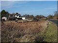


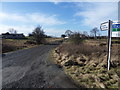

10 photos from this area
Area Information
Key information about the CH8 8LG including its size, population, and administrative classification.
- Area Type
- Postcode
- Area Size
- 1.0 km²
- Population
- 2106
- Population Density
- 175 people/km²
House Prices in CH8 8LG
30
Properties
£196,696
Average Sold Price
£38,000
Lowest Price
£389,000
Highest Price
Showing 30 properties
| Address | Type | Beds | Baths | Last Sale Price | Last Sale Date | |
|---|---|---|---|---|---|---|
| Fernside, Naid Y March Junction To Chapel Junction, Calcot, CH8 8LG | Retail | 1 | 1 | £140,000 | Apr 2022 | |
| Caban Y Gwynt, Narrow Lane, Calcot, CH8 8LG | Detached | - | - | £160,000 | Oct 2020 | |
| Deen Care Ltd, Allerton Lodge Care Home, Naid Y March Junction To Chapel Junction, Calcot, CH8 8LG | hospital_care_home | - | - | £346,000 | Feb 2018 | |
| Bro Dawel, Naid Y March Junction To Chapel Junction, Calcot, CH8 8LG | Bungalow | - | - | £220,000 | Mar 2010 | |
| Bryn Hyfryd, Narrow Lane, Calcot, CH8 8LG | Detached | - | - | £360,000 | Oct 2007 | |
| The Tunnel, Naid Y March Junction To Chapel Junction, Calcot, CH8 8LG | Detached | 4 | 3 | £389,000 | Jul 2006 | |
| Preswylfa, Naid Y March Junction To Chapel Junction, Calcot, CH8 8LG | Semi-detached | - | - | £138,000 | Nov 2005 | |
| Two Stones, Naid Y March Junction To Chapel Junction, Calcot, CH8 8LG | Detached | - | - | £348,000 | Oct 2004 | |
| Windy Ridge, Naid Y March Junction To Chapel Junction, Calcot, CH8 8LG | Detached | 5 | 2 | £195,250 | Sep 2004 | |
| Garreg Lwyd, Naid Y March Junction To Chapel Junction, Calcot, CH8 8LG | Detached | - | - | £150,000 | Nov 1999 |
Page 1 of 3
Energy Efficiency in CH8 8LG
Amenities
Schools
| Rank | School | Type | Entry gender | Ages |
|---|
Explore more schools in this area
Go to Schools tabDemographics
Household Size
Two person
most common
Accommodation Type
Houses
most common
Tenure
81
majority
Ethnic Group
White
most common
Religion
N/A
most common
Household Composition
N/A
most common
Age
47
median
Adults (30-64 years)
most common
Household Deprivation
N/A
with no deprivation
NS-SEC
32
in Lower managerial occupations
Explore more demographic insights in this area
Go to Demographics tabPlanning
Planning Constraints
- Flood RiskPremium
- Ramsar Wetland SitesPremium
- Area of Outstanding Natural BeautyPremium
- Protected Nature ReservePremium
- Protected WoodlandPremium
- Crime RiskPremium