Area Overview for CH8 7PG
Photos of CH8 7PG
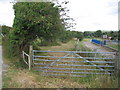
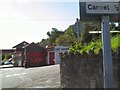
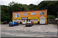
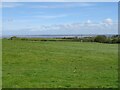
12 photos from this area
Area Information
Key information about the CH8 7PG including its size, population, and administrative classification.
- Area Type
- Postcode
- Area Size
- 1.9 hectares
- Population
- 2442
- Population Density
- 924 people/km²
House Prices in CH8 7PG
37
Properties
£83,626
Average Sold Price
£27,500
Lowest Price
£135,250
Highest Price
Showing 37 properties
| Address | Type | Beds | Baths | Last Sale Price | Last Sale Date | |
|---|---|---|---|---|---|---|
| 30 Lon Goed, Holway, CH8 7PG | house | - | - | £127,000 | Dec 2024 | |
| 9 Lon Goed, Holway, CH8 7PG | house | - | - | £110,000 | Apr 2024 | |
| 22 Lon Goed, Holway, CH8 7PG | Semi-detached | 3 | 1 | £133,000 | Aug 2023 | |
| 10 Lon Goed, Holway, CH8 7PG | Semi-detached | 3 | 1 | £135,250 | Jul 2023 | |
| 15 Lon Goed, Holway, CH8 7PG | Terraced | 2 | 2 | £117,000 | Apr 2023 | |
| 5A Lon Goed, Holway, CH8 7PG | Terraced | 2 | - | £110,000 | Jan 2023 | |
| 2 Lon Goed, Holway, CH8 7PG | Retail | 2 | 1 | £127,500 | May 2022 | |
| 20 Lon Goed, Holway, CH8 7PG | Semi-detached | 3 | 1 | £125,000 | Jan 2022 | |
| 8 Lon Goed, Holway, CH8 7PG | Terraced | 2 | 2 | £105,500 | Nov 2021 | |
| 19 Lon Goed, Holway, CH8 7PG | Terraced | 2 | 1 | £89,950 | Sep 2018 |
Page 1 of 4
Energy Efficiency in CH8 7PG
Amenities
Schools
| Rank | School | Type | Entry gender | Ages |
|---|
Explore more schools in this area
Go to Schools tabDemographics
Household Size
Family (3-5 people)
most common
Accommodation Type
Houses
most common
Tenure
74
majority
Ethnic Group
White
most common
Religion
N/A
most common
Household Composition
N/A
most common
Age
47
median
Adults (30-64 years)
most common
Household Deprivation
N/A
with no deprivation
NS-SEC
31
in Lower managerial occupations
Explore more demographic insights in this area
Go to Demographics tabPlanning
Planning Constraints
- Flood RiskPremium
- Ramsar Wetland SitesPremium
- Area of Outstanding Natural BeautyPremium
- Protected Nature ReservePremium
- Protected WoodlandPremium
- Crime RiskPremium