Area Overview for CH7 6YQ
Photos of CH7 6YQ
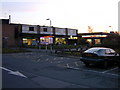
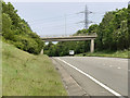
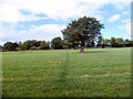
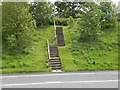
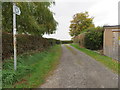
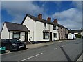
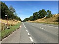
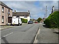

10 photos from this area
Area Information
Key information about the CH7 6YQ including its size, population, and administrative classification.
- Area Type
- Postcode
- Area Size
- 4.5 hectares
- Population
- 1379
- Population Density
- 942 people/km²
House Prices in CH7 6YQ
44
Properties
£202,275
Average Sold Price
£59,950
Lowest Price
£275,000
Highest Price
Showing 44 properties
| Address | Type | Beds | Baths | Last Sale Price | Last Sale Date | |
|---|---|---|---|---|---|---|
| 42 Bron Yr Eglwys, Mynydd Isa, CH7 6YQ | Bungalow | 4 | 1 | £260,000 | Feb 2024 | |
| 5 Bron Yr Eglwys, Mynydd Isa, CH7 6YQ | Detached | 5 | - | £275,000 | Jan 2024 | |
| 31 Bron Yr Eglwys, Mynydd Isa, CH7 6YQ | house | - | - | £231,000 | Oct 2022 | |
| 33 Bron Yr Eglwys, Mynydd Isa, CH7 6YQ | Semi-detached | 3 | 1 | £235,500 | Aug 2022 | |
| 30 Bron Yr Eglwys, Mynydd Isa, CH7 6YQ | house | - | - | £230,000 | Jan 2021 | |
| 18 Bron Yr Eglwys, Mynydd Isa, CH7 6YQ | Detached | 4 | - | £240,000 | May 2018 | |
| 24 Bron Yr Eglwys, Mynydd Isa, CH7 6YQ | Detached | 4 | 1 | £220,000 | Mar 2018 | |
| 15 Bron Yr Eglwys, Mynydd Isa, CH7 6YQ | Detached | 5 | - | £240,000 | Nov 2017 | |
| Nant Y Coed, Bron Yr Eglwys, Mynydd Isa, CH7 6YQ | Detached | 4 | 1 | £270,000 | Jun 2014 | |
| 26 Bron Yr Eglwys, Mynydd Isa, CH7 6YQ | house | 4 | - | £240,000 | Sep 2012 |
Page 1 of 5
Energy Efficiency in CH7 6YQ
Amenities
Schools
| Rank | School | Type | Entry gender | Ages |
|---|
Explore more schools in this area
Go to Schools tabDemographics
Household Size
Two person
most common
Accommodation Type
Houses
most common
Tenure
83
majority
Ethnic Group
White
most common
Religion
N/A
most common
Household Composition
N/A
most common
Age
47
median
Adults (30-64 years)
most common
Household Deprivation
N/A
with no deprivation
NS-SEC
37
in Lower managerial occupations
Explore more demographic insights in this area
Go to Demographics tabPlanning
Planning Constraints
- Flood RiskPremium
- Ramsar Wetland SitesPremium
- Area of Outstanding Natural BeautyPremium
- Protected Nature ReservePremium
- Protected WoodlandPremium
- Crime RiskPremium