Area Overview for CH7 6UP
Photos of CH7 6UP
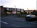
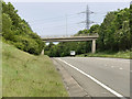
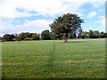
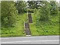
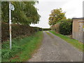
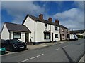
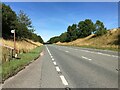
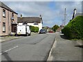
10 photos from this area
Area Information
Key information about the CH7 6UP including its size, population, and administrative classification.
- Area Type
- Postcode
- Area Size
- 8963 m²
- Population
- 1424
- Population Density
- 461 people/km²
House Prices in CH7 6UP
22
Properties
£154,727
Average Sold Price
£109,000
Lowest Price
£193,000
Highest Price
Showing 22 properties
| Address | Type | Beds | Baths | Last Sale Price | Last Sale Date | |
|---|---|---|---|---|---|---|
| 14 Grays Road, Mynydd Isa, CH7 6UP | Bungalow | 3 | 1 | £180,000 | Jul 2025 | |
| 6 Grays Road, Mynydd Isa, CH7 6UP | Bungalow | 2 | 1 | £193,000 | Apr 2025 | |
| 10 Grays Road, Mynydd Isa, CH7 6UP | Semi-detached | 2 | 1 | £170,000 | Nov 2022 | |
| Ahtohallan, 13 Grays Road, Mynydd Isa, CH7 6UP | house | - | - | £193,000 | Feb 2021 | |
| 19 Grays Road, Mynydd Isa, CH7 6UP | Semi-detached | 3 | 1 | £150,000 | Feb 2014 | |
| 7 Grays Road, Mynydd Isa, CH7 6UP | house | - | - | £147,500 | Mar 2013 | |
| 16 Grays Road, Mynydd Isa, CH7 6UP | Semi-detached | - | - | £150,000 | May 2007 | |
| 12 Grays Road, Mynydd Isa, CH7 6UP | Bungalow | 3 | 1 | £145,000 | Jul 2006 | |
| 8 Grays Road, Mynydd Isa, CH7 6UP | Semi-detached | - | - | £128,000 | May 2005 | |
| 24 Grays Road, Mynydd Isa, CH7 6UP | house | - | - | £136,500 | May 2004 |
Page 1 of 3
Energy Efficiency in CH7 6UP
Amenities
Schools
| Rank | School | Type | Entry gender | Ages |
|---|
Explore more schools in this area
Go to Schools tabDemographics
Household Size
Two person
most common
Accommodation Type
Houses
most common
Tenure
88
majority
Ethnic Group
White
most common
Religion
N/A
most common
Household Composition
N/A
most common
Age
47
median
Adults (30-64 years)
most common
Household Deprivation
N/A
with no deprivation
NS-SEC
35
in Lower managerial occupations
Explore more demographic insights in this area
Go to Demographics tabPlanning
Planning Constraints
- Flood RiskPremium
- Ramsar Wetland SitesPremium
- Area of Outstanding Natural BeautyPremium
- Protected Nature ReservePremium
- Protected WoodlandPremium
- Crime RiskPremium