Area Overview for CH7 6RY
Photos of CH7 6RY
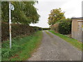
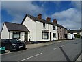
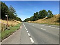
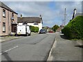
10 photos from this area
Area Information
Key information about the CH7 6RY including its size, population, and administrative classification.
- Area Type
- Postcode
- Area Size
- 20.5 hectares
- Population
- 1634
- Population Density
- 1318 people/km²
House Prices in CH7 6RY
29
Properties
£290,290
Average Sold Price
£59,950
Lowest Price
£516,500
Highest Price
Showing 29 properties
| Address | Type | Beds | Baths | Last Sale Price | Last Sale Date | |
|---|---|---|---|---|---|---|
| 6 Bryn Road, Bryn Y Baal, CH7 6RY | Bungalow | 4 | 1 | £330,000 | Sep 2023 | |
| Ardboyne, Bryn Road, Bryn Y Baal, CH7 6RY | house | 4 | 2 | £485,000 | Sep 2023 | |
| Top Farm, Bryn Road, Bryn Y Baal, CH7 6RY | Detached | 4 | 2 | £516,500 | Jul 2023 | |
| Orchard House, Bryn Road, Bryn Y Baal, CH7 6RY | house | - | - | £415,000 | Dec 2020 | |
| Ty Newydd, Bryn Road, Bryn Y Baal, CH7 6RY | Detached | 4 | 1 | £370,000 | Oct 2019 | |
| Climar Tiagh, 4 Bryn Road, Bryn Y Baal, CH7 6RY | Bungalow | - | - | £209,000 | Sep 2016 | |
| 2 Bryn Road, Bryn Y Baal, CH7 6RY | Bungalow | - | - | £202,500 | Apr 2011 | |
| Rockcliffe House, Bryn Road, Bryn Y Baal, CH7 6RY | Detached | - | - | £249,950 | Oct 2007 | |
| Mymms Cottage, Bryn Road, Bryn Y Baal, CH7 6RY | Detached | - | - | £65,000 | Aug 1997 | |
| Alyn Cottage, Bryn Road, Bryn Y Baal, CH7 6RY | Detached | - | - | £59,950 | Mar 1995 |
Page 1 of 3
Energy Efficiency in CH7 6RY
Amenities
Schools
| Rank | School | Type | Entry gender | Ages |
|---|
Explore more schools in this area
Go to Schools tabDemographics
Household Size
Two person
most common
Accommodation Type
Houses
most common
Tenure
89
majority
Ethnic Group
White
most common
Religion
N/A
most common
Household Composition
N/A
most common
Age
47
median
Adults (30-64 years)
most common
Household Deprivation
N/A
with no deprivation
NS-SEC
39
in Lower managerial occupations
Explore more demographic insights in this area
Go to Demographics tabPlanning
Planning Constraints
- Flood RiskPremium
- Ramsar Wetland SitesPremium
- Area of Outstanding Natural BeautyPremium
- Protected Nature ReservePremium
- Crime RiskPremium