Area Overview for CH7 6PT
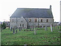
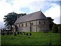
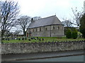
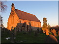
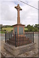
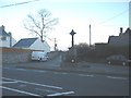
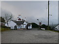
Photos of CH7 6PT
Area Information
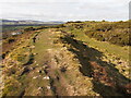
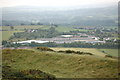
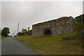
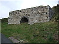
Living in the CH7 6PT postcode area means residing within a specific residential cluster located in Halkyn, a village in Flintshire, north-east Wales. This small geographical area covers approximately 9,063 square metres and accommodates a population of 1,717 residents. The community sits between Pentre Halkyn, Northop, and Rhosesmor, offering views over the Dee Estuary. You will find yourself in a setting shaped by over two thousand years of history, including ancient Roman lead mining and the medieval influence of the Grosvenor family. The village itself has been remixed over centuries, with its church relocated and Halkyn Castle constructed during the 1820s. Today, the civil parish population aligns closely with the local figures, creating a tight-knit environment where daily life moves at a deliberate pace. The electoral ward encompasses the villages of Halkyn, Rhes-y-cae, and Rhosesmor, integrating these communities into a single functional area. Residents here benefit from proximity to the sea while remaining grounded in a historic village environment that dates back to the Domesday Book. The area retains its distinct character, separate from the larger urban centres of the region.
- Area Type
- Postcode
- Area Size
- 9063 m²
- Population
- 1717
- Population Density
- 68 people/km²
The property market in CH7 6PT is defined by a strong preference for owner-occupation. With 81 percent of homes being owner-occupied, the overwhelming majority of properties are freehold houses rather than leasehold flats or rental units. This statistic indicates that the area is predominantly suited for buyers who intend to stay long-term rather than short-term investors or tenants looking for a portable home. The accommodation type data confirms that houses are the standard living arrangement, eliminating the need for buyers to consider apartments or purpose-built flats for this specific postcode. The local real estate landscape is traditional, reflecting the village's historic origins and rural nature. Potential buyers looking at homes in this area should expect a market driven by settled families and older professionals. The high ownership rate often points to lower permanent rates and a sense of stability in tenure. While specific sale prices are not detailed in the available records, the housing type and ownership structure signal a market where residents buy to live, not necessarily to flip. This makes CH7 6PT a practical choice for those seeking a conventional household stock without the complexities of mixed-use developments.
House Prices in CH7 6PT
Showing 2 properties
| Address | Type | Beds | Baths | Last Sale Price | Last Sale Date | |
|---|---|---|---|---|---|---|
| Coed Bach Cottage, Ochr Y Foel From Wern Y Gaer Junction To B 5123 Junction Including Link Adjacent To Church, Rhosesmor, CH7 6PT | house | - | - | £276,000 | Dec 2020 | |
| Ty Cerrig, Ochr Y Foel From Wern Y Gaer Junction To B 5123 Junction Including Link Adjacent To Church, Rhosesmor, CH7 6PT | Semi-detached | - | - | - | - |
Energy Efficiency in CH7 6PT
Your daily lifestyle in CH7 6PT revolves around practical amenities and historic community hubs. You have access to four retail locations, including Lidl Mold, Iceland Flint, and Farmfoods Flint, ensuring food and grocery needs are met without extensive travel. For dining and socialising, the village offers two public houses: the Britannia and the award-winning Blue Bell Inn. The Blue Bell Inn notably operates a post office alongside its bar services, integrating essential shopping with leisure. Historic and recreational culture is present through local leisure options such as Halkyn United F.C. and its cricket club. The area also maintains a local library, preserving access to books and community resources. Parking and services are consolidated within venues; for instance, the post office is run as part of the Blue Bell Inn, reflecting a traditional high-street model common in rural Wales. These facilities form a cohesive network where residents can handle grocery shopping, postal requirements, and socialising without leaving the immediate parish. The proximity of these amenities ensures that the village remains functional for retirement, farming families, or remote workers alike.
Amenities
Schools
Families considering schools near CH7 6PT have two nearby options listed within the immediate vicinity of the village. These educational institutions are other-led, indicating their specific administrative classification within the Welsh system. The schools in the local area are Ysgol Rhos Helyg and Rhes-Y-Cae Controlled. Both institutions serve the local community and provide education close to residents' homes. The presence of these two options supports the village's status as a self-contained community where families live within walking distance or a short drive of their children's education. While detailed Ofsted ratings for these specific sites are not included in the current dataset, both represent permanent establishments serving the local catchment. The mix of school types available ensures that prospective parents can evaluate options suitable for their children. Living in Halkyn means that access to formal education does not require traveling significant distances into larger towns. The availability of Ysgol Rhos Helyg and Rhes-Y-Cae Controlled highlights the village's commitment to providing essential infrastructure for its younger residents.
| Rank | School | Type | Entry gender | Ages |
|---|
Explore more schools in this area
Go to Schools tabDemographics
The demographic profile of CH7 6PT reflects a mature community with a median age of 47 years. The most common age range among residents consists of adults between 30 and 64 years old, indicating a population that has largely settled rather than the transient nature of many student towns or commuter hubs. A significant majority of households, specifically 81 percent, are owner-occupied. This high ownership rate suggests a community invested in their local properties and likely置业 across multiple generations. The predominant accommodation type in this postcode is houses, meaning flats and apartments are not a feature of this specific address. The ethnic composition is predominantly White, mirroring the broader pattern of rural Welsh villages. With a population density of 68 people per square kilometre, the area offers ample green space and a low-density living environment. This demographic stability creates a quiet neighbourhood where long-term residents form the core of social networks. The housing stock caters predominantly to families or individuals seeking a house rather than an apartment, reinforcing the residential character of the village.
Household Size
Accommodation Type
Tenure
Ethnic Group
Religion
Household Composition
Age
Household Deprivation
NS-SEC
Explore more demographic insights in this area
Go to Demographics tabPlanning
Planning Constraints
- Flood RiskPremium
- Ramsar Wetland SitesPremium
- Area of Outstanding Natural BeautyPremium
- Protected Nature ReservePremium
- Protected WoodlandPremium
- Crime RiskPremium