Area Overview for CH7 6LA
Photos of CH7 6LA
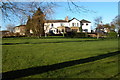
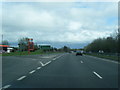
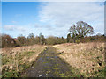
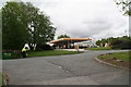

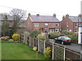
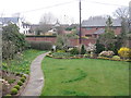

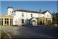
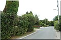
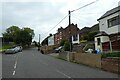
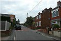
22 photos from this area
Area Information
Key information about the CH7 6LA including its size, population, and administrative classification.
- Area Type
- Postcode
- Area Size
- 1.2 hectares
- Population
- 1826
- Population Density
- 517 people/km²
House Prices in CH7 6LA
12
Properties
£257,064
Average Sold Price
£179,950
Lowest Price
£400,000
Highest Price
Showing 12 properties
| Address | Type | Beds | Baths | Last Sale Price | Last Sale Date | |
|---|---|---|---|---|---|---|
| Heather Lea, Institute Lane, Northop Hall, CH7 6LA | Semi-detached | 3 | - | £191,500 | Aug 2022 | |
| Sunnymeade, Institute Lane, Northop Hall, CH7 6LA | house | - | - | £400,000 | Mar 2022 | |
| Langdon, Institute Lane, Northop Hall, CH7 6LA | house | - | - | £180,000 | Sep 2021 | |
| Brackendale, Institute Lane, Northop Hall, CH7 6LA | Detached | 4 | - | £330,000 | Jan 2020 | |
| Bryn Goleu, Institute Lane, Northop Hall, CH7 6LA | Semi-detached | 2 | 1 | £179,950 | Nov 2018 | |
| Pine Ridge, Institute Lane, Northop Hall, CH7 6LA | house | - | - | £280,000 | Oct 2018 | |
| The Oaks, Institute Lane, Northop Hall, CH7 6LA | house | - | - | £238,000 | May 2014 | |
| Fairfield, Institute Lane, Northop Hall, CH7 6LA | house | 3 | - | - | - | |
| Avondale, Institute Lane, Northop Hall, CH7 6LA | Semi-detached | - | - | - | - | |
| Erw Lon, Institute Lane, Northop Hall, CH7 6LA | Detached | - | - | - | - |
Page 1 of 2
Energy Efficiency in CH7 6LA
Amenities
Schools
| Rank | School | Type | Entry gender | Ages |
|---|
Explore more schools in this area
Go to Schools tabDemographics
Household Size
Two person
most common
Accommodation Type
Houses
most common
Tenure
85
majority
Ethnic Group
White
most common
Religion
N/A
most common
Household Composition
N/A
most common
Age
47
median
Adults (30-64 years)
most common
Household Deprivation
N/A
with no deprivation
NS-SEC
41
in Lower managerial occupations
Explore more demographic insights in this area
Go to Demographics tabPlanning
Planning Constraints
- Flood RiskPremium
- Ramsar Wetland SitesPremium
- Area of Outstanding Natural BeautyPremium
- Protected Nature ReservePremium
- Protected WoodlandPremium
- Crime RiskPremium