Area Overview for CH7 6GU
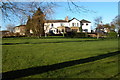
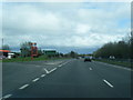
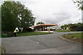
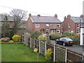
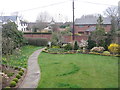
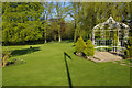
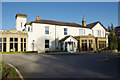
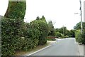
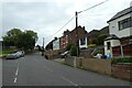
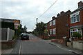
Photos of CH7 6GU

Area Information
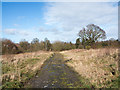
Living in CH7 6GU, a small residential postcode area in North East Wales, offers a blend of rural tranquillity and historical depth. Nestled near Mold and the A55 North Wales Expressway, this village is part of the civil parish of Northop Hall, home to around 1,826 residents. The area’s character is shaped by its 13th-century manor house, Northop Hall, and a heritage rooted in agriculture and industry. While the population density of 517 people per square kilometre suggests a tight-knit community, the village has expanded significantly since the 20th century, with post-war developments adding modern housing. Daily life here is defined by its proximity to nature, with no major planning constraints like protected woodlands or AONBs. Residents enjoy access to local amenities such as Morrisons and Co-op stores, while the nearby Shotton and Hawarden railway stations link to broader networks. The area’s appeal lies in its balance of historical significance, practical connectivity, and a predominantly owner-occupied community of adults aged 30–64, making it a stable yet evolving place to live.
- Area Type
- Postcode
- Area Size
- Not available
- Population
- 1826
- Population Density
- 517 people/km²
The property market in CH7 6GU is characterised by high home ownership (85%) and a focus on individual houses rather than apartments or shared housing. This suggests a market primarily catering to owner-occupiers, with limited rental availability. The prevalence of houses indicates a preference for larger, private properties, which may appeal to families or those seeking space. Given the area’s small size and low population density, the housing stock is likely to be spread out, with developments concentrated in post-war estates and smaller-scale builds. Buyers should consider that the market is not geared toward investors or renters, and property values may be influenced by the area’s historical and rural attributes. Proximity to the A55 and rail links adds practical appeal, though the lack of major urban infrastructure means properties are more likely to be valued for their tranquillity than their connectivity.
House Prices in CH7 6GU
No properties found in this postcode.
Energy Efficiency in CH7 6GU
Life in CH7 6GU is shaped by its accessible amenities, which include five retail outlets such as Morrisons Wepre Connah’s and Co-op St, ensuring everyday shopping needs are met. The village’s proximity to rail stations like Shotton High Level and Hawarden Bridge offers convenient links to nearby towns and cities, while the Hawarden Airport provides a minor aviation connection. Locally, the area retains a rural character, with landmarks like the 13th-century Northop Hall and the Analemmatic Dial at the Edith Bankes Memorial Institute adding to its historical appeal. The cricket club and public houses, such as the Boar’s Head and Black Lion, foster a strong community spirit. While the area lacks large-scale leisure facilities, its small-scale charm and practical amenities make it ideal for those seeking a balance between rural tranquillity and functional connectivity.
Amenities
Schools
The nearest school to CH7 6GU is Northop Hall C.P. School, which falls under the ‘other’ category in the data. While specific Ofsted ratings are not provided, the presence of a primary school suggests the area supports local education for younger children. The absence of secondary schools or specialist institutions means families may need to look further afield for comprehensive schooling. This could be a consideration for those prioritising proximity to a full range of educational facilities. However, the village’s historical ties to education—such as the 1609-established Free Grammar School—hint at a tradition of learning, though modern provision remains limited to primary levels. Parents should factor in travel time to secondary schools in nearby towns like Mold or Wrexham.
| Rank | School | Type | Entry gender | Ages |
|---|
Explore more schools in this area
Go to Schools tabDemographics
CH7 6GU has a median age of 47, with the majority of residents falling within the 30–64 age range. This suggests a mature, established community, likely with strong family ties and a focus on long-term stability. Home ownership is high at 85%, reflecting a preference for private residences over rentals, which is typical in smaller rural areas. The accommodation type is predominantly houses, indicating a lack of high-density housing or flats. The predominant ethnic group is White, though specific data on diversity or deprivation is not provided. The age profile and ownership rates imply a community with limited generational turnover, where most residents have lived in the area for years. This stability may contribute to a cohesive local identity, though it also means the area is less likely to attract younger professionals or transient populations. The absence of detailed diversity metrics means broader demographic trends remain unexplored.
Household Size
Accommodation Type
Tenure
Ethnic Group
Religion
Household Composition
Age
Household Deprivation
NS-SEC
Explore more demographic insights in this area
Go to Demographics tabPlanning
Planning Constraints
- Flood RiskPremium
- Ramsar Wetland SitesPremium
- Area of Outstanding Natural BeautyPremium
- Protected Nature ReservePremium
- Protected WoodlandPremium
- Crime RiskPremium