Area Overview for CH7 6FT
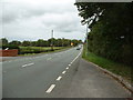
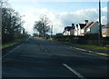
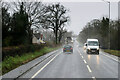
Photos of CH7 6FT
Area Information
Living in CH7 6FT means residing within a specific postcode area that forms a small residential cluster in Buckley, Flintshire, Wales. This locality covers a compact space of 4,716 square metres yet accommodates a population of 1,486 people. The density here stands at 537 people per square kilometre, creating a tight-knit environment typical of established Welsh communities. Buckley itself is a town with historic roots, documented back to 1086 under Cheshire entries and recorded as Bokkeley in 1294 as the pasturage of Ewloe Manor. The area has evolved from an industrial centre known for pottery and coal mining into a quieter residential zone. St Matthew's Church, consecrated in 1822, remains a central landmark in the local landscape. While the modern town community has grown to 16,135 residents, this specific postcode area offers a more intimate slice of that heritage. Daily life involves navigating a neighbourhood where proximity to Hawarden Airport and local railway stations shapes the rhythm of the week. The setting sits on the historic manor pasturage of Ewloe, blending ancient history with contemporary living for those who choose this specific corner of the region.
- Area Type
- Postcode
- Area Size
- 4716 m²
- Population
- 1486
- Population Density
- 537 people/km²
The property market in CH7 6FT is characterised by a high concentration of owner-occupied homes. With 83% of the population owning their residences, the local housing stock is defined by stability and established families rather than a dynamic rental sector. The predominant accommodation type is houses, meaning you will rarely see flats or terraced blocks in this specific residential cluster. This high ownership rate suggests that buyers in CH7 6FT purchase with long-term intentions, often upgrading or improving their current properties rather than swapping frequently. The area comprises a small residential terrain, so the total number of homes available is limited compared to larger urban districts. Potential buyers looking at homes in CH7 6FT should expect a market driven by purchase transactions between existing owners. The lack of rental data in the local record reinforces the fact that the private market dominates here. If you are considering buying, you are entering a landscape where residents have deep roots. The property values likely reflect this steady demand from those seeking secure housing in a historic Welsh town.
House Prices in CH7 6FT
Showing 5 properties
| Address | Type | Beds | Baths | Last Sale Price | Last Sale Date | |
|---|---|---|---|---|---|---|
| 5 Alder Close, Alltami, CH7 6FT | house | - | - | £260,000 | Nov 2019 | |
| 3 Alder Close, Alltami, CH7 6FT | Detached | 4 | 3 | £237,500 | Dec 2018 | |
| 1 Alder Close, Alltami, CH7 6FT | Detached | 4 | 2 | £290,000 | Nov 2018 | |
| 2 Alder Close, Alltami, CH7 6FT | Detached | 4 | 2 | £249,995 | Sep 2017 | |
| 4 Alder Close, Alltami, CH7 6FT | house | - | - | £249,995 | Jul 2017 |
Energy Efficiency in CH7 6FT
Your lifestyle in CH7 6FT revolves around the practical reach of essential amenities and historic town centres. Within practical distance, you have access to several retail options, including Spar and Iceland Buckley, ensuring that daily shopping needs are met without long travel times. Transport connectivity is strong, with Buckley Railway Station, Hawarden Railway Station, and Penyffordd Railway Station all serving the local community easily. The presence of Buckley Town & Heritage Trail allows residents to explore local history on foot or by bike. Hawarden Airport sits nearby, offering convenient flight options for those requiring air travel. Religious life is supported by sites like St Matthew's Church and Bistre Emmanuel Parish Church, which serve the spiritual needs of the community. You will find leisure facilities near the Elfed Sports Complex, which is known for its non-conformist bell tower mound. The Buckley Society provides a resource for understanding the deep history of the area, from the first pottery in 1737 to the modern town. Daily life balances these conveniences with the quiet character of a neighbourhood where 83% of people own their homes.
Amenities
Schools
| Rank | School | Type | Entry gender | Ages |
|---|
Explore more schools in this area
Go to Schools tabDemographics
The community in CH7 6FT reflects a mature demographic profile. The median age is 47, indicating a settlement dominated by adults between 30 and 64 years of age. This age range forms the most common group within the residential cluster, suggesting families or individuals in their peak working years have chosen this location. Home ownership is the primary form of tenure, with 83% of residents owning their homes outright. This high figure of 83% points to a stable, established neighbourhood rather than one dominated by transient rentals. Almost all residents live in houses, consistent with the accommodation type classification for the area. The predominant ethnic group is White, aligning with the broader demographic trends of Flintshire and rural Wales. The data does not provide specific deprivation statistics or income breakdowns, so the focus remains on the clear picture of homeownership and age. You will find a population settled in brick and tile rather than newly arriving renters, creating a sense of permanence. This demographic structure supports local businesses on a consistent basis while maintaining a steady demand for servicing an older, home-owning population.
Household Size
Accommodation Type
Tenure
Ethnic Group
Religion
Household Composition
Age
Household Deprivation
NS-SEC
Explore more demographic insights in this area
Go to Demographics tabPlanning
Planning Constraints
- Flood RiskPremium
- Ramsar Wetland SitesPremium
- Area of Outstanding Natural BeautyPremium
- Protected Nature ReservePremium
- Protected WoodlandPremium
- Crime RiskPremium